
The Importance of Maps
Since maps are such an important part of our research, I have found these to put online. I wish I could have made them bigger for you but they would take so much longer to view. As they are now, it will take about 2 minutes to load each one.
Maps can help us find where our ancestors were. Be sure to pay close attention to boundary changes. Could that elusive record you've been searching for be in another county? or even another state? Maps can also help us figure out how our ancestors got to Clinton County. Try tracing migration trails to find out where they may have been. A family may have started out from New York but, due to lack of money, illness, pregnancy, bad weather, etc., they may have had to stop in Indiana for a year or two (or even longer) before moving on.
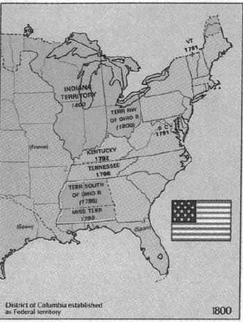
1800: Iowa belonged to France.
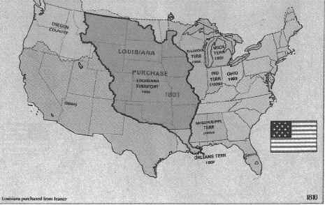
1810: Iowa became part of the Louisiana Purchase in 1803.
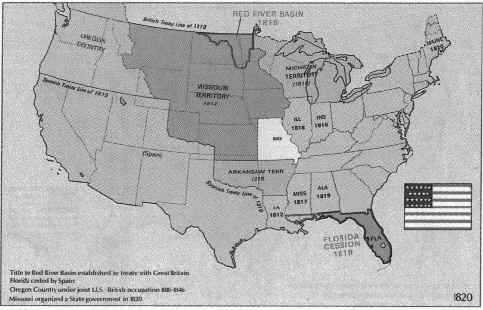
1820: Iowa became part of the Missouri Territory in 1812.
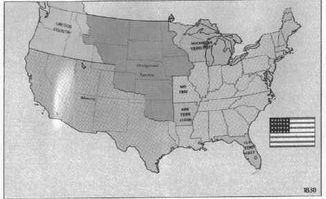
1830: Iowa is in unorganized territory.
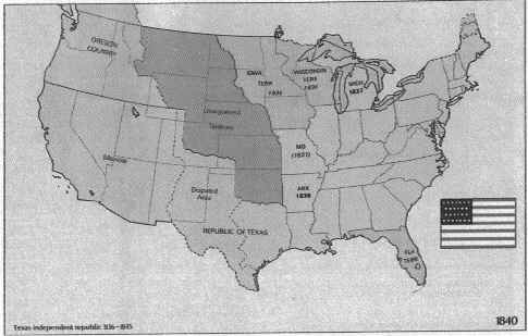
1840: Iowa Territory.
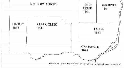
1841: Township borders in Clinton County.
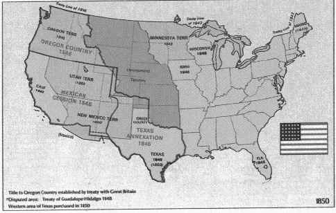
1850: Iowa has been a state since 1846.
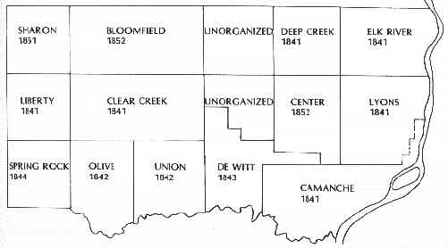
1852: With the addition of Sharon, Bloomfield and Center Townships, Clinton County had 13 townships by 1852.
1860: The railroad lines going West.
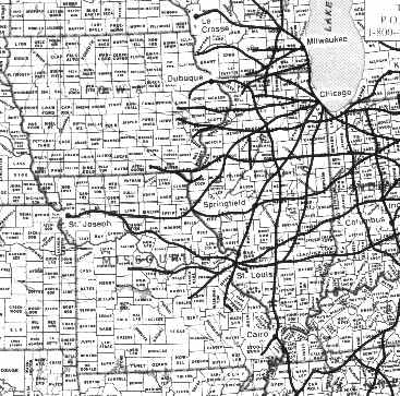
1875: In 1875 Clinton County had 21 townships.
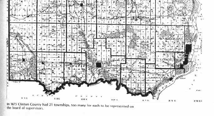
1893: Brookfield Twp and Elwood map
Chancy and East Chancy: I will have to check on the year of this map. This one is quite large and may take as much as 5 minutes to view. From what I understand, a local business has copies of this map for $5.00 each.
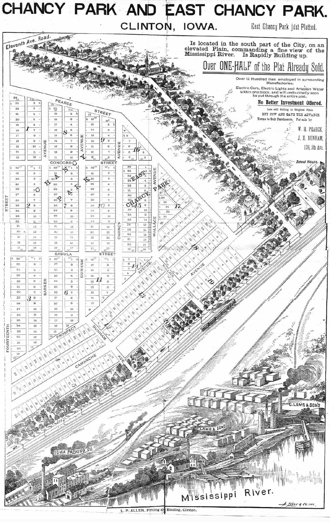
1897: This map shows what a railroad mecca Clinton was.
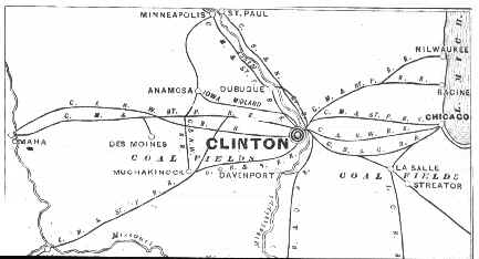
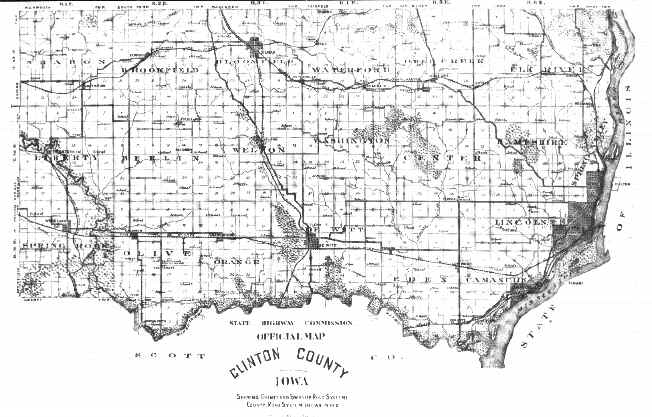
1913:This township map shows the roads and railroads in CC.
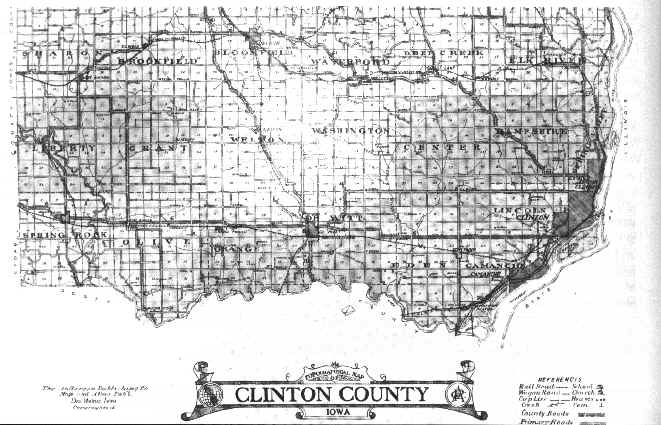
1925:The darkest lines on this map are county or primary roads.
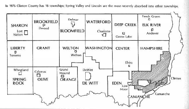
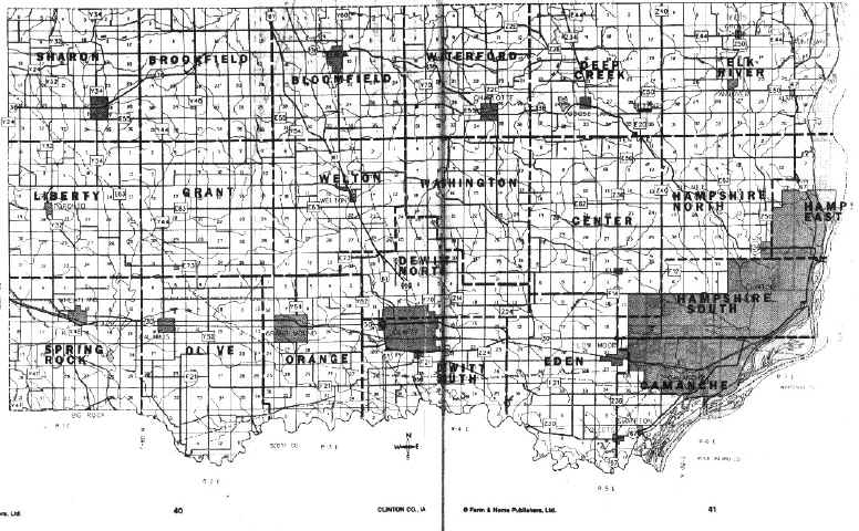
1976: There are now 18 townships in CC.
Tom Greenwald writes: I wanted to bring to your attention a nice
bird's-eye view map of Lyons, Iowa in 1868 that is available from the library of
Congress at:
https://www.loc.gov/maps/collections/
Click on cities and towns and search for Lyons. There is also one for
DeWitt. (These maps are also available through the Clinton
County Historical Society but they are in black and white. I'm pretty sure
there is one for Clinton.)
Sources: 1976 "History of Clinton County Iowa" by the Clinton County Historical Society and Everton's "Handybook for Genealogists" 8th Ed.