
4
Management (BLM) or the National Archives of the
United States.
Locating Patents and Land Entry Case Files
for all thirty Public Land
States is detailed in "Federal Land Records", in
GENEALOGY BULLETIN No. 12, (Oct-Nov-Dec
1991), pp 1-7; and for an update on the thirteen
states covered by the Eastern States Branch of
the BLM, see "Bureau of Land Management
Automated Records Project", in GENEALOGY
BULLETIN No. 19, (Jul-Aug-Sep 1993), pp 8-9.
(Back issues of the Bulletin are available from
AGLL, Inc., PO Box 329, Bountiful, UT 84011).
Since the patent was not a document issued at
the
county
level, it may not
be obvious from
local
records
that a man had
an
original
entry of land.
The patent did
not have to be
recorded at the
county unless the property was sold. But in many
counties, genealogists may find a record book
called "Original Entries of Land" which gives the
names and property description for those persons
who obtained original patents for land in a
particular county.
There may also be Voter's Lists, Tax Lists, or
County Assessor's records which confirm that a
person was a patent holder based on a county
tax liability against his property. You may also
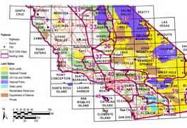
find a county-wide "Plat Book" which shows the
same information. A Plat Book is a map showing
the physical location of property ownership within
a particular county or region of a county. If any
of these types of records survive today, they are
usually located today at the county courthouse
for the county wherein the land was located.
Another source for confirming if a man had an
original entry of land is land ownership maps that
have been published privately by several book
publishers, generally for the 1800s. Based on
county-wide
plat
maps
and
other
public
documents, private companies have produced
land ownership maps for about half of the
counties of the U.S., some as large sheets,
others as bound books. The Library of Congress
in Washington, DC has the best collection of
these old land ownership maps. There are two
excellent guides to locate a map for a county and
to determine if your ancestor's name appears on
one of these maps. The first is for the manuscript
maps (sheets) located in the Library of Congress:
1)
Richard
W.
Stepenson,
compiler,
Land
Ownership Maps: A Checklist of Nineteenth
Century United States County Maps in the Library
of Congress, (Washington, DC: Geography and
Map Division, Reference Department, Library of
Congress), 1967; and 2) Land Ownership Atlases
in the Library of Congress, which is a county-by-
county index to the various land ownership
atlases that have been produced. To obtain
copies of these maps, write to the Library of
Congress
and
specify the name
of the county, the
town,
township,
or area of the
county in which
you
have
an
interest, and the
time
period.
Mention the two
sources for land ownership maps. Write to Library
of
Congress,
Photoduplication
Services,
Washington, DC 20540. The staff will determine if
such a map or atlas exists, and will quote you a
price for making a copy of the maps for you.
Subsequent Exchanges of Land
After a patent had been issued to a landowner,
he had the right to sell the land to someone else
in the form of a deed, but the recording of such
land sales became a local responsibility. Unlike
the warrant, surveys, or patents, which were
recorded at the state or federal level, exchanges
of land subsequent to the land grant process are
recorded at the county level. This is true for all
states except three New England States, where
the deeds are recorded at the town level
(Connecticut, Rhode Island, and Vermont), and
Alaska, the only state with no counties and where
land exchanges are recorded at the Judicial
District level. In Louisiana, deeds are recorded at
the parish level, which is the same
as a county in other states.
Some definitions related to land
exchanges at the county or town
level are as follows:
Deed...
the
private