HISTORICAL
CHAPTER XII.
TRAVEL, TRANSPORTATION AND COMMUNICATION.
EARLY ROADS IN SHELBY COUNTY.
Beginning in 1854 and continuing throughout the terms of the county judges of Shelbv county many roads were established. Some of these roads were surveyed, but many were not. Some of them appear to have been laid out in so general a course and perhaps so irregularly traveled that it often became uncertain in a few years as to exactly where the roads ran.
OLD STATE COACH.(Courtesy of E. R. Harlan, Curator of State Historical Department of Iowa.) Photo by Hosteller, Des Moines, Iowa.
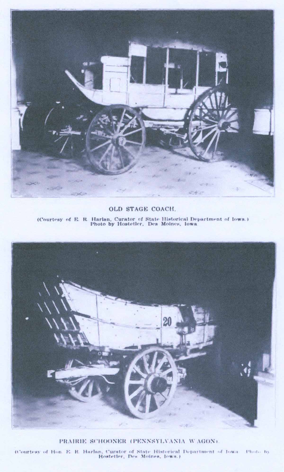 PRAIRIE SCHOONER PENNSYLVANIA WAGON.
(Courtesy of Hon. E. R. Harlan, Curator of State Historical Department of Iowa. Photo by Hostetler, Des Moines, Iowa.)
The first petition for a county road seems to have been presented to Nelson Ward, county judge, on July 3, 1854. This petition sought the establishment of a road from the east line of Shelby county west by way of Cuppy's Grove, thence crossing Silver creek and thence to Council Bluffs. Accordingly, on December 4, 1854, the said road was established as follows: "Commencing at the cast line of the county in township 78 north, thence west to the crossing of Indian creek, from thence to the crossing of Walnut creek slews, thence west to the crossing of the East Nishna Botany in Cuppy's Grove, thence to the crossing of the main Nishna crossing between Hack's and Waterbury's, thence one hundred yards south of Waterbury's house to the crossing of Silver creek, forty rods above the old crossing on said creek, thence South West about two miles to the South line of Shelby county."
Dwight Terrill, then residing at Bowman's Grove, was appointed commissioner to view said road and report thereon prior to its establishment, and on September 11, 1854, had reported favorably.
On September 1, 1856, County Judge David Baughman established a road beginning at the north boundary line of Shelby county fifty poles east of the section corner between sections 2 and 3 in Grove township, thence west to Shelbyville, thence in the direction of Samuel Wood's to the Harrison county line. On the same date there was also established a county road reported by Abraham Rubendall, of Cuppy's Grove, commissioner, beginning at the east line of Shelby county north of township line 79 and 80, range line between 36 and 37 [the beginning of this road would from this description run near the north boundary of Jackson township near the village of Poplar, Audubon county], at the southeast corner of section 1, forty rods north of said corner, thence to Adams' and Sweat's bridge, thence to the geographical center of Shelby county [north of Harlan a mile or slightly more], thence to Shelbyville (in section 27, Grove township), thence to the west line of Grove township, thirty-four rods north of the southwest corner of section 19 in said township.
On December 3, 1856, David Baughman, county judge, established another county road reported by Abraham Rubendall. commissioner, beginning at the northeast corner of section 12, intersecting a certain county road in Audubon county on the range line between ratiges 36 and 37 in township 78 (Clay township, southeast of the present town of Elkhorn), running to the northeast corner of Correction Grove (in section 5, Clay township), thence past Bowman's Grove in section 12 to Bowman's bridge and running into section 4, intersecting a certain road known as Adams' road, near L. D. Sunderland's, in township 79, range 38 (Center township).
On March 1, 1858, County Judge Tarkington established a countv road
(19)
reported by William McGinness, commissioner, commencing at the town of Somida, running westwardly to the county line near B. F. Leland's in township 79, range 40 (Cass township), the said road to be known as the Somida and Leland road.
It also appears from the road book that on July 5, 1858, John McIntosh, of Grove township, as commissioner, had reported on the Manteno and Nishnabotna road, beginning at Adams' and Sweat's bridge at Bowman's Grove (this bridge was located where the present county bridge crosses the Nishbotna [sic Nishnabotna] river at Bowman's Grove east of the Daniel Terrill farm in Center township), thence to the southwest corner of the northwest quarter of section 1 in Center township, thence in an irregular course to the middle fork of the West Nishnabotna river (the branch of the stream at Harlan flowing northeast past Kirkman and Irwin), thence across the west fork of the same stream and then on to Mosquito creek in the west part of the county to the center stake between sections 11 and 14 of Grove township to the south end of the old West House, thence crossing Mill Creek near the residence of Washington Roundy and then into the village of Manteno, the said road being twenty-three miles and thirteen chains in length.
In January, 1850, there was established a county road known as the Manteno and Harlan road. David Baughman, as commissioner, reported on the road. This road began at Manteno, ran through Shelbyville and Harlan, crossed the J. M. Long bridge (probably located near the old Chatburn mill and near the present Harlan city pumping station), thence across the Cuppy bridge to Cuppy's Grove and thence to a point between sections 35 and 36, township 78, range 38 (Monroe township), on the south boundary line of Shelby county, slightly north and east of Walnut, Pottawattamie county. Mr. Baughman reported that the said terminus of the road was between Indian and Walnut creek sloughs. The reported length of the road was thirty-four miles and two hundred and ninetv-six rods.
The early pioneers of Monroe, Jackson and parts of other townships recall vividly the many unhappy experiences they had in hauling grain to Walnut across these marshy sloughs in the seventies. On many an occasion farmers were compelled to double up their teams to help each other out of impassable places where moderately loaded wagons sometimes sank almost to the hubs. Grain was sometimes hauled, of course, in sacks, part of which had to be removed from the wagon-box before the wagon could be pulled out of these dangerous places. To add to the enjoyment of the occasion, a luckless pioneer would sometimes be favored with the very best performance of a balky horse or team.
On October 4, 1858, there was established the Newtown and Denison roads, forty feet in width. This road was viewed and reported on by Peter H. Longcor, commissioner, of Bowman's Grove. The road began at a point one hundred and sixteen poles west of the southwest corner of section 33, Fairview township, on the Pottawattamie county line and ran thence to the town of Somidaa, thence to the southwest corner of the northeast quarter of the southeast quarter of section 8, now Center township, thence north to the Crawford county line.
Perhaps, in passing, it should be noted that this road book at about this point on page 23 sets out the field notes of that part of the Panora (Guthrie county) Soldier creek State Road, elsewhere in this work referred to, but apparently does not indicate at just what point on the east county line of Shelby county it entered. It seems likely, however, that the road entered Shelby county at about the northeast corner of Jackson township east of Bowman's Grove, or perhaps slightly northeast of the grove. In any event, the first definite station in the survey referred to is J. H. Adams' residence, which was a log cabin on the old farm, later known as the premises of Eliab Myers, in the north part of Bowman's Grove. It is likely that from this point a surveyor could determine accurately the general course of the highway and by starting at Panora, provided the field notes are preserved in the early counties traversed by the road, he could determine the point at which the road entered Shelby county on the east. Running from the residence of Mr. Adams, the course of the road as surveyed crossed the quarter section corner between sections 1 and 6, in township 79, ranges 37 and 38 (which was on the boundary line between the present townships of Jackson and Center), thence across Brandywine creek (which was the high sounding historical name given by the surveyors or others before them to the branch of the Nishnabotna river running by Bowman's Grove), thence to the quarter section corners between sections 1 and 2, 2 and 3, and 3 and 4, respectively, in Center township, thence to a point at or near Sunderland's branch (L. D. Sunderland in Center township), thence across the West Nishnabotna river (running northeast past Kirkman and Irwin), thence across the west fork of the Nishnabotna river, crossing in its course the quarter section corners between sections 4 and 5, and 5 and 6 in Center township, thence crossing two streams designated as Quick run and Hill creek (not known by those names today), thence to the corner of sections 8, 9, 16 and 17, in township 79, range 39 (Lincoln township), thence to the quarter section corner between sections 8 and 17 of said township, thence across ____ creek and Keg creek to Moskito creek, and finally terminating six chains and nine one-hundredths links south of the section corner of sections 1, 6, 7 and 12, township 79, ranges 40 and 41 (on the western boundary of Cass township, one mile south of the northwest corner of said township).
On January 3, 1859, there was established a county road running from the Adams and Sweat bridge at Bowman's Grove, crossing a branch of the Nishnabotna near Milton Stanton's and the west branch of the same stream near Harlan, thence crossing Silver creek to an intersection further west of the Panora and Soldier Creek state road at the northeast corner of section 16, township 79, range 39, and from that point westward coinciding with the line of the said state road to the crossing of Moskito creek in section 10 of Cass township, the said road being nine miles and three hundred and ten rods in length.
In the foregoing treatment of early roads in Shelby county the author has set out the substance of most of the information contained in this first road book of Shelby county. Of course, as the population in the county grew and the needs of better means of communication became greater, many new roads were petitioned for and granted. The above record covers the period of time up to 1860. It should be remembered that these roads in a large measure followed the ridges and did not follow the section lines, except as the section lines happened to be on what at the time appeared to be the best and most practicable routes of travel. If the reader will bear in mind the location in general of the very earliest settlements in the county and will picture in his mind's eye winding roads that ran from these various settlements to the others, winding trails that avoided so far as possible the swampy sloughs and marshes which in an early day were much more prevalent than now, and if the reader will also keep in mind that bridges over the streams were few and far between; that a traveler was free to drive wherever his horses could walk and draw his wagon absolutely unhampered by fences of any sort and seldom by trees, he can construct for himself the lines of travel over these primitive ridge roads in Shelby.
Transcribed by Cheryl Siebrass, February, 2024 from the Past and Present of Shelby County, Iowa, by Edward S. White, P.A., LL. B.,Volume 1, Indianapolis: B. F. Bowen & Co., 1915, pp. 288-292.
|
