|
|
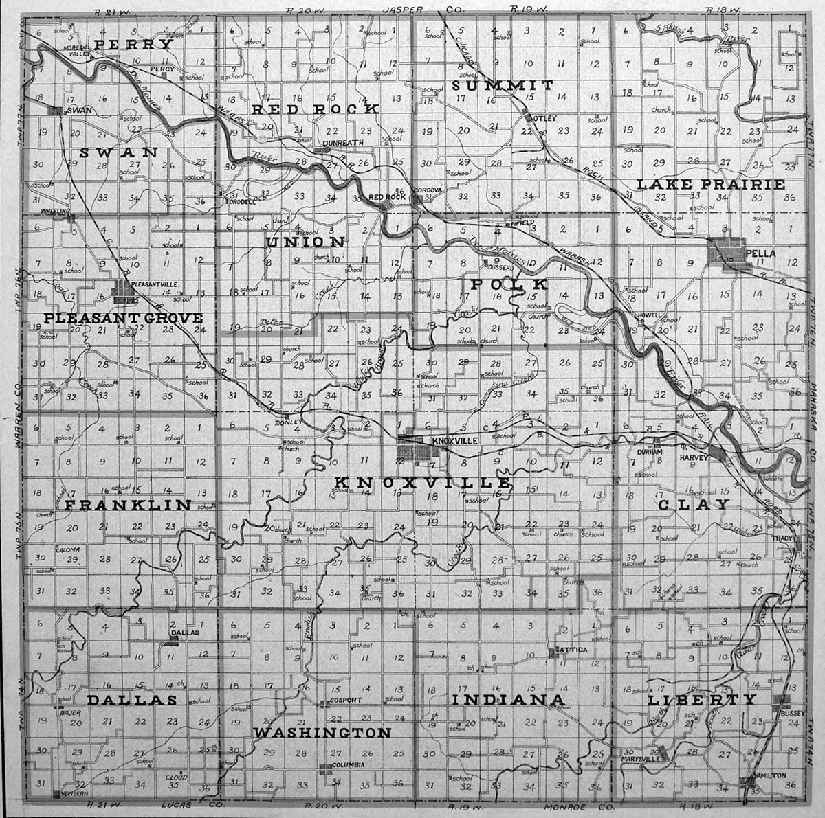
For a visual overview, see the two maps below. For larger maps, see a digitized map at University of Iowa. There you can find enlarged maps for each county found on the right of this page.
Below is a table of the townships in marion county. Note that the ordering of the townships roughly follows from top to bottom and west to east. The table includes the township and range values as well as a description of where they are other relative to other townships. See maps below. For further information on the concept of township, range, and related ideas see here or, for more details, see here. Note that the Des Moines River complicates a bit the standard or typical 6x6 mile-square townships, so the township and range values are sometimes approximations in Marion county.
| Name | Township, Range | Location |
|---|---|---|
| Perry | T 77N, R 21W | in NW corner |
| Red Rock | T 77N, R 20W | just east of Perry on north border |
| Summit | T 77N, R 19W | just east of Red Rock on north border - includes Otley |
| Lake Prairie | T 77N, R 18W | in NE corner but extends down to Des Moines river - includes Pella |
| Swan | T 77N, R 21W | just south of Perry (and on west boundary) with Des Moines river the boundary between them |
| Union | T 76N, R 20W | just south of Red Rock with Des Moines river the boundary between them |
| Polk | T 76N, R 19W | just south of Summit with Des Moines river the boundary between them |
| Pleasant Grove | T 76N, R 21W | just south of Swan on west boundary - includes Pleasantville |
| Knoxville | T 75N, R 19,20W | central township, includes town of Knoxville |
| Franklin | T 75N, R 21W | on west boundary, south of Pleasant Grove and west of Knoxville |
| Clay | T 75,76N, R 18W | just south of Lake Prairie and east of Knoxville - on eastern boundary - includes Tracy and Harvey |
| Dallas | T 74N, R 21W | in SW corner |
| Washington | T 74N, R 20W | just east of Dallas |
| Indiana | T 74N, R 19W | just east of Washington and west of Liberty - includes Attica |
| Liberty | T 74N, R 18W | in SE corner - includes Bussey |
Below is a basic map of where the townships are within Marion county. This is from 1901. Note also that the sections are numbered, if you look closely.
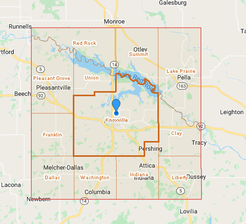
Below is another basic, but more modern, map that shows today's towns. Note that it also shows some changes to the townships (likely after Lake Red Rock was formed by damming the Des Moines river). Here is a brief summary.
If you would like to view a more detailed and modern county map, check out the pdf file for the county that is dated Jan. 1, 2023. It shows the townships as below, but not as clear since all the roads are also listed, but it is a great map if you want to bike the back roads of the county. If you would like a black and white version of this, try here. The gravel roads don't jump out so much.
This page was revised by Al Hibbard on 2024-04-04.