
|
|
|
What's New | Bios | Birth/Marr/Death | Cemeteries | Census | Courts | Directories/Lists | History | Land & Property | Military | Photos & Postcards | Resources | Schools
| Click
on a thumbnail
to view the full size map. These are large maps
and may be slow in opening, but worth the extra time it takes to open
them. These maps (full size view) save well and then can be printed in their entirety. Because of their size, when trying to print them directly from the webpage, they may print only a portion of the map. |
| LINKS TO MAPS | |||
|
|
|
|
|
|
1949 Official Cover |
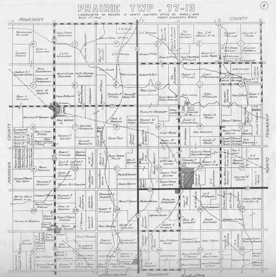
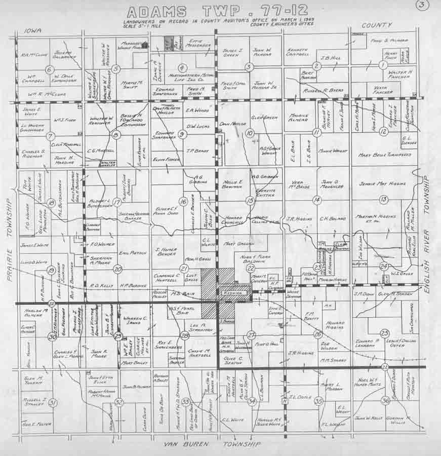
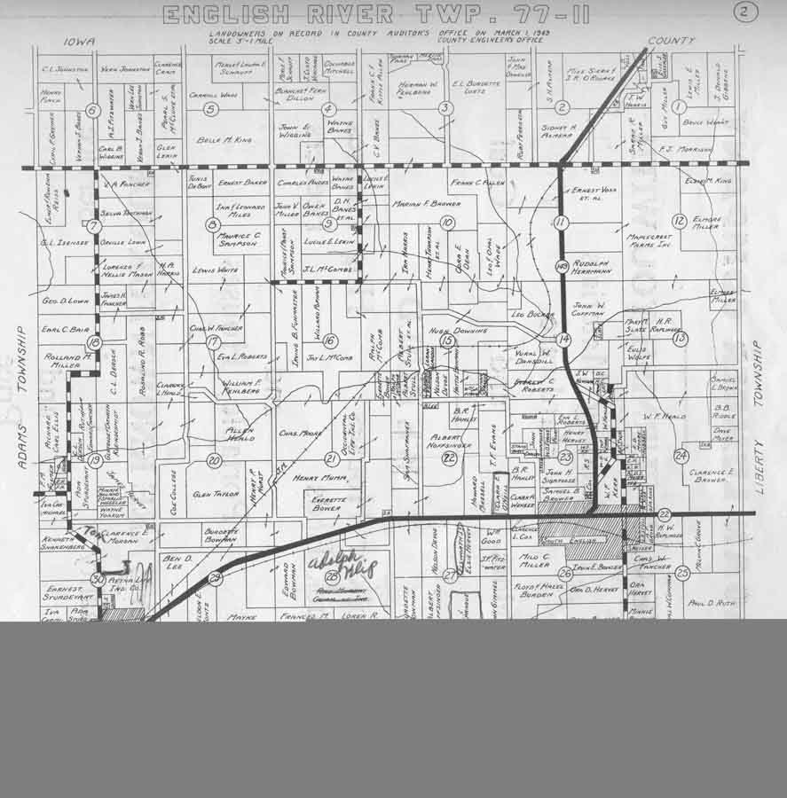
Prairie | Adams | English River |
|
|
|
|
|
|
Liberty |
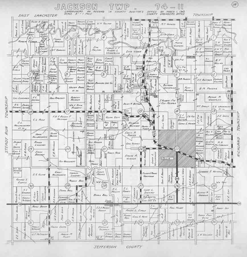
Jackson |
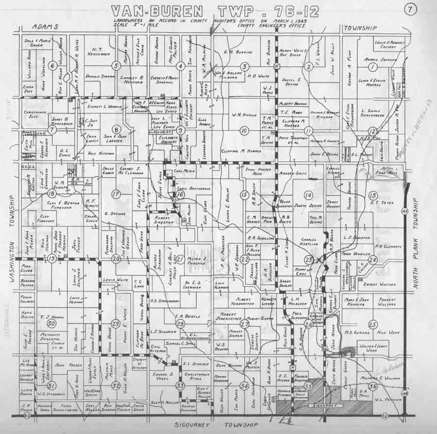
Van Buren |
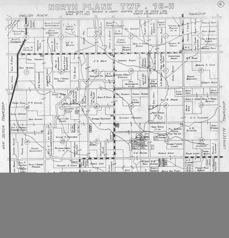
North Plank |
|
|
|
 |
 |
|
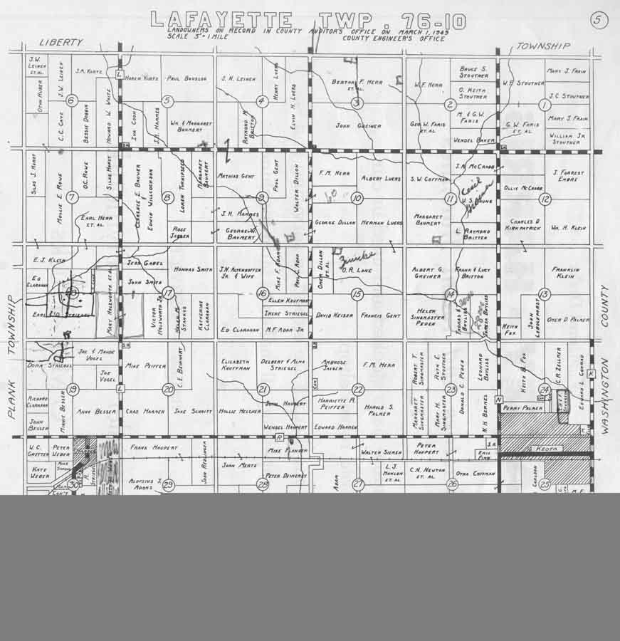
Lafayette |
South Plank & East Lancaster |
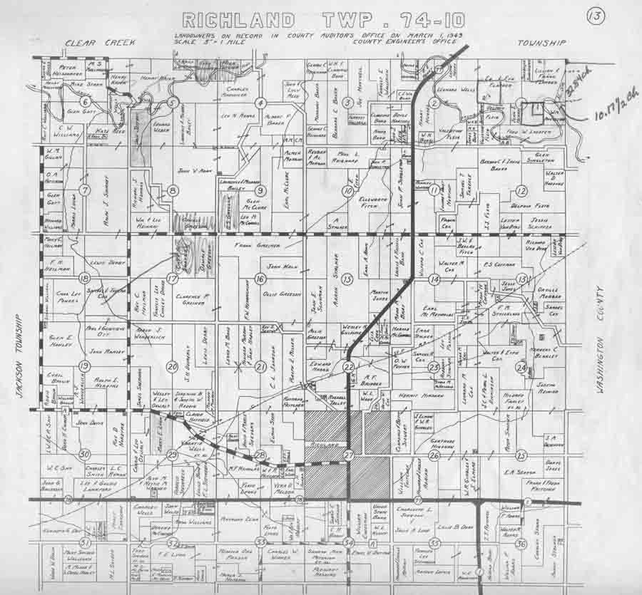
Richland |
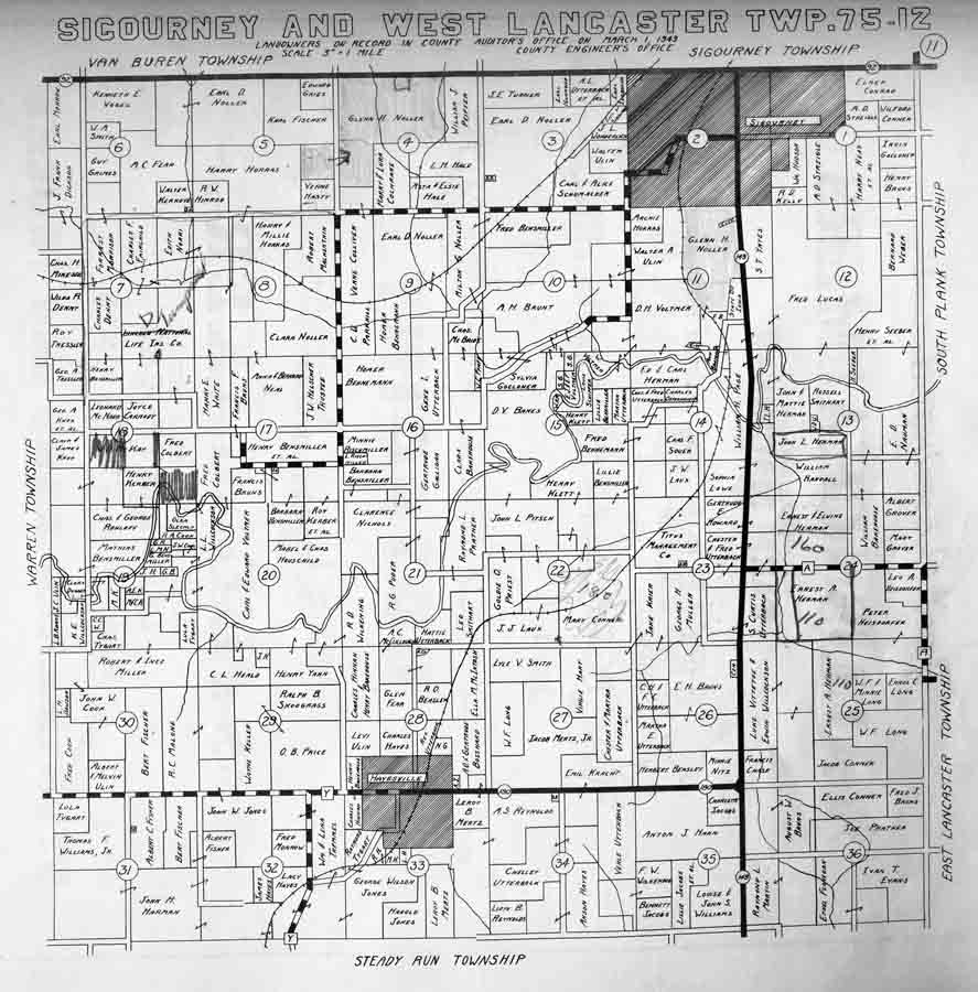
Sigourney & West Lancaster |
| |
|||
| Keokuk County | |||