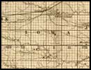
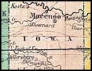
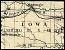
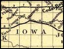
Iowa County Maps, 1850 - 1897
Details of Iowa County taken from various Iowa State maps. (Listed below are locations called out on each map.)
Including plat maps and farm directories
Steve Williams will do lookups (from material donated by Sharyl Ferrall)
 1886 Plat of Iowa County, 1900 Atlas (and Plat), 1913 Plat, 1917 Plat, 1930 Plat
University of Iowa: Iowa Digital Library
Parcel/Land Search with the best aerial images of Iowa County you can find! (This site is difficult to navigate. Have patients and you may find it rewarding.)
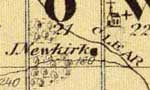
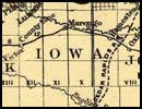
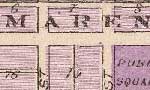
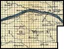
Iowa County Township Maps
Publisher: Chicago: Andreas Atlas Co.
Shows towns, post offices, landowners, farm houses, schools, churches, mills, blacksmith
shops, roads, railroads, timber, swamps, bluffs, etc.
Plan of the City of Marengo
Publisher: Chicago: Andreas Atlas Co.
Shows wards, tracts, landowners, streets, block numbers, etc.
 Cover Image
List of Landowners & Features:
Part 1
(2167 Records)
Part 2
(2168 Records)
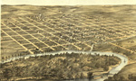
Bird's Eye View of Marengo
Publisher: Chicago, Merchants Lithographing Co. [1868]
Drawn by A. Ruger.
Includes illus. and index to points of interest.
Details of Iowa County taken from various Iowa State maps. (Listed below are locations called out on each map.)
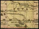
 1881
1881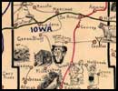 1897
1897