THE HANSON AND GLYNN FAMILIES
Part II: A SHORT HISTORY OF FAMILY MIGRATIONS FROM EUROPE TO AMERICA AND SOUTH DAKOTA.
© Copyright January 3, 2006 by Richard S. and Doreothe A. Hanson. All rights reserved Revised June 13, 2008
A. SOME RELEVANT IRISH HISTORY.
MY NATIVE LAND by Tom Shea
Oh land of my birth far across the wild ocean
O'er the wastes of the waters my heart flies to thee,
As the wild bird uncaged flies away to the woodland
And pours out his heart in the song of the free.In dreams I have roamed once again through thy valleys
Or rode through thy forests to hunt the wild deer,
The dawn sometimes finds me on heather clad hillsides,
But alas! I awaken and find I am here.Far away from the island where loved ones are sleeping
I'm forced to continue my life far apart.
In the land of my forefathers ancient in glory
The tyrant still strangles the Queen of my heart.Yet! Dearly I love this free land I have chosen
Where great men once banished the tyrant away,
From the shores of Columbia unfastened his clutches
And routed his redcoats in battle array.Still pensive I dream of the moor and the meadow
Of nests in the bushes where speckled hens laid,
Where the cry of the hound and the song of the reaper
Rang out through the land where in childhood I played.Oh! Ireland! One prayer in my heart I keep ever,
To the end of my life with each ounce of my will
God grant that the tyrant be flung from thy borders
And the fall of his footsteps forever be still!
Ireland has an ancient and very rich history. Throughout history it has been known for its literature, its faith, and unique music. It was not a subject of the Romans and other invaders whose conquests led to destruction of the centers of enlightenment on the continent of Europe during the early Middle Ages from AD 800 to about AD 1170. This period is known as the Dark Ages in continental Europe. However, these were the golden years of Irish ascendancy beginning with general Irish literacy to the Golden Ages of Irish enlightenment. Much of the enlightenment is due to the monasteries that thrived during this period. Many important documents and manuscripts were prepared and some were preserved. The Normans invaders destroyed many. Remarkable among these are the Confessio of St. Patrick in about AD 400 and the Book of Kells, an illuminated manuscript of the Gospels produced about AD 800. The latter manuscript is owned by Trinity College in Dublin and is displayed there. There are legends about how it was produced in a monastery. Irish missionaries were largely responsible for bringing education to the continent after the invaders left and centers of education were again established. The many Scandinavian Vikings that invaded parts of Ireland periodically settled and intermarried by the time they were defeated and driven out in 1014. Many Irish names are of Norman or Scandinavian origins but the Glynns, Flynns, Bolands, and McGouns appear to be original Irish names dating to times before the Viking conquests. The Hansons probably went to the island as Scandinavian invaders or settlers after AD 800.
After 1690 until modern times the British subjugated Ireland. As a result of the condemnation of Henry VIII by the Vatican because he divorced Kathryn and married Anne Boleyn during his reign (1509-1547) in the 16th century, he declared himself head of the Church of England (Act of Supremacy). He beheaded or divorced other wives and one died of natural causes. He set about attempts to crush the Catholic Church in England. Needless to say, his relationship with Rome continued to decline. Following Henry VIII, due in large part to the reigns of his daughters Mary and Elizabeth, the Church of England was the religion of the land with some exceptions. The short reign of James II, (1685-1688) gave relief from the protestant oppression.
The parliament established by James II when he landed in Ireland, proposed to confiscate the Protestant lands. After the defeat of the Catholic King James II by William of Orange at the Battle of Boyne in 1690, the Irish Parliament became entirely protestant. It enacted laws to make sure that the Catholic majority would never again endanger the Protestant ascendancy on the Island. The result was the Penal Laws, which in essence forbade the practice of the Catholic religion and the banishment of all Papists from the kingdom. Catholic lands were confiscated and by 1700, less than 15% of the land in Ireland was owned by native Irish persons. Ireland was further subjugated by being incorporated into the British Empire without representation for the majority of the Irish. Even those protestant religions particularly the Presbyterians who were known as dissenters that did not belong to the Church of England suffered.
In the Penal Code of 1704, a Popery Code was enacted forbidding Catholics from sitting in Parliament, acting as game-keepers, constables or solicitors, possessing horses valued at more than 5 pounds, attend a university, keep a school, send children abroad for education, serve as schoolmaster, buy or receive land from a Protestant, bequeath an estate as a whole to a Catholic son, become the guardian of a child, etc. The Irish parliament was dissolved under the 1800 Act of Union and Ireland became an integrated part of England. Parliament instituted a forced charge or tithe to support the Protestant Church of Ireland. There were several unsuccessful attempts at rebellion (referred to as Risings) by the Catholics including several between 1798 and the 1840s. The Catholics were largely disenfranchised. They were largely tenant farmers or laborers. Secret societies of Catholics were formed to oppose British rule. These societies became very militant and violent over the years.
A tithe war raged in the late1830s with widespread risings but all the attempts at rebellion were put down. Catholics did not have the organization due to suppression or the resources to oust the British or gain sufficient political control to oppose the Protestants who continued to impoverish them through passage of legislation. These riots, suppressed rebellions, assassinations, etc., were often referred to as “The Troubles”. The Catholics were a majority of the population and their enfranchisement was greatly feared if the union with the U.K. was dissolved.
In 1823, with the help of the Catholic Church that was allowed to function albeit with some restrictions, Daniel O’Connell, a famous lawyer from County Clare, founded the Catholic Association with a very small membership fee administered by the Church.
O’Connell was said to be a brilliant person, a very talented orator, a famous defense attorney and champion of the poor and disenfranchised. In 1828, O’Connelll stood for election in Clare and won a seat in parliament. He was allowed to be seated and did not have to sign an oath of Supremacy of the British over Ireland because of the support of the Whigs in Parliament. In a thumbnail history of Ireland on the Irish History website, this is said to have restored Catholic rights. However, the British government increased the franchise limit and the poorer Catholics were the majority of those deprived of the vote. O’Connell’s supporters of the Catholic/Whig coalition lost the majority in the elections of 1835 and the Catholics were again marginalized as a social group and were again subject to rule by the Protestant elite for a short period (History of County Clare on Internet). However, O’Connell dominated Irish politics for over 40 years and he persisted in getting Irish Catholics elected to the British House of Commons and the Penal Codes were finally repealed. He would draw audiences of half a million people when he spoke and the English could not adequately oppose his parliamentary expertise and ability to convince people of his point of view. He is often referred to as “The Liberator” in Irish histories. He was effective as was Parnell later in using the English Common Law developed by and after the Magna Carta of 1515 to obtain rights for Irish people because they were full subjects of the crown and could not legally be denied their rights.
“The English had attacked the Irish identity by outlawing their religion and language, and the possibility of ownership or education” (Quotes from Frank Delaney in Ireland a novel). The English however did not succeed in destroying the Irish identity and their sense of belonging to the land and a culture that was uniquely theirs. “They were also very good at turning out lots of little Irish Catholics.” The man who is credited with restoring Irish property rights and stimulating Ireland on its way to independence was Charles Stewart Parnell. Parnell had as his cause the reestablishment of property rights of the Irish who were dispossessed by the English landlords, many of whom lived in England on grand estates and had managers take care of their Irish lands. He, like O’Connell was a gifted orator and a politician able to organize people into effective political forces. He led the Irish politicians in the House of Commons in London. He was an English landowner in Ireland who sympathized with the Irish who were deprived of their lands. He was married to an American. He was able to attract the support of American Irish emigrants. He spoke in Iowa on one occasion and Parnell, IA was named for him. It is just a few miles west of Holbrook where the Hanson family settled. He organized boycotts of English landlords, which effectively deprived them of the labor needed to operate their land holdings and to obtain other resources. They abandoned estates due to financial losses. When lands of the Irish were put on the auction block because of English persecution, no one bid for them because it was known that those buying them would be blockaded as well. The Irish began to acquire their lands back. Because the Irish identity is tied to their ownership of land, they achieved some measure of self-esteem again. Parnell also succeeded in getting a greater degree of self-governance for Ireland. These events took place in the nineteenth century beginning about 1830. Parnell took a fancy to a beautiful wife of a colleague in Parliament and eventually divorced his American born wife and married the wife of his friend. The devout Catholic supporters of Parnell could not forgive these sins and he was defeated in his next election attempt.
These problems led to most of the Irish emigration before 1845. The potato blight, 1845-1848, caused widespread famine particularly among the tenant farmers and laborers and resulted in more emigration. Catholics again were greatly affected and many died of disease associated with malnutrition. Because the Protestants and British controlled the wealth and the government, the provision of support for the starving was next to nil. The British exported grain from Ireland while the tenant farmers starved. These policies illustrated the terrible religious divides in Ireland that persisted after 1900. The strife in Northern Ireland continued with the support of many Southern Irish Catholics and Catholic emigrants up to recent times. Memories of the past have died a very slow death.
Ireland is a small island country. The island is 120 miles wide at the widest part and extends 270 miles from the southernmost to northernmost points. It is not square shaped but more closely resembles an American football in shape. Some parts are very fertile and others have very thin rocky soil unsuited for farming. The poorer Catholic Irish had large families and the sustainable population was small in the absence of modern world commerce. About 1/3rd of the population of New Foundland is of Irish descent and there are many Irish in New Zealand, South America, Canada, Australia, The United States, and spread around continental Europe. Many Irish arrived in America in colonial times and settled in northeastern America and eventually down the coast to the Carolinas by the time of the revolution. Many Glynns arrived during this period. There is a Glynn monument near Niagara Falls. Migrations accelerated in the early 1800s and throughout the famines. Many traveled on “coffin ships” that were crowded, had poor food and sanitation and took on average about three weeks to make the crossing. Many perished including the second wife of Michael Hanson and a child of John Konechne. Now that peace has been achieved and economic prosperity is becoming a reality, a net reverse migration is occurring.
Some Irish people like Thomas and Stephen Hanson left Ireland in the early 1830s in response to the landlord system, the violence, and the suppression of the political rights of Catholics. Prior to 1845 County Westmeath had a population of 141,000, which decreased by 21% by 1851 due to emigration and deaths through famine.
When they reached the U.S., they formed societies that assisted the emigration of others and it is stated in the History of Williamsburg Iowa, Vol. II, 2007 that the societies and the American Hansons in particular provided the funds for Michael Hanson, their father and my great-great grandfather, as well as the remainder of Michael’s children in Ireland to follow them. There were estimated to be 1.5 million people of Irish birth living in America at the end of the 19th century.
The emigrants supported secret societies including groups called “circles” that were oath bound secret societies of the idealistic poor for the most part. The Irish Brotherhood or the church did not support them. The revolutionary Irish Brotherhood was said to have a membership of 80,000 people. Despite several sporadic battles and attempted risings that resulted in hangings of leaders of groups like the Manchester Martyrs little was accomplished in the late 1860s except they focused the minds of the masses on the injustices of English rule. In 1909 the Irish Republican Brotherhood gained popularity and volunteers were recruited to fight in risings. It was said that they had 150 companies and as many as 15,000 admittedly poorly armed men ready to fight. A rising was started on Easter Monday in 1916 and was put down by English reinforcements including gun ships and cannon in the towers of Trinity College. O’Connell street that housed the poor was virtually destroyed as were the buildings occupied by the Irish rebels. Many were convicted of insurrection and given life sentences, some were hanged and many were killed in the battles. The war of independence followed in 1919 resulting in the formation of the Irish Free State.
In 1923, the first government of the Irish Free State was formed by William Cosgrave of Cuman Na nGael. The name of the state is officially Ireland or Eire in the Irish language. It is defined in its constitution as an independent, sovereign, and democratic state. The partition or political division of Ireland in 1921 made independence of Southern Ireland and events leading to the current economic prosperity possible in Southern Ireland. Northern Ireland is composed of 6 of the 32 counties of Ireland and continues a political union with Britain. At last Ireland is enjoying a period of relative peace and prosperity. The Irish who came to America were largely Catholic and tended to settle in communities with other Irish Catholics. These areas included Iowa County, Iowa (Hansons), Monroe County, Iowa (Glynns), and Dubuque County (The Bolands). James and Mary Flynn, Doreothe’s great grandparents settled in York Township, Fillmore County Minnesota on the Iowa/Minnesota border although it seems other Flynns preceded them in Iowa before moving to Minnesota near the Mississippi and the south branch of the Root River. Several younger Flynns in Minnesota in the 1860s were born in Iowa according to census documents of that time. It should be pointed out that there are many more Glynns and Flynns in New England than elsewhere. Many arrived before 1800. There is a large Glynn monument in Niagara Falls New York and online searches lead to many along the eastern coast of the U.S. particularly New England and the state of New York.
The prejudices that existed in Ireland followed many to the eastern coast of America. Most Irish settled in eastern cities. They were subjected to discrimination while Irish farmers in what was then the Western U.S. frontier had greater freedom. The areas of Iowa they settled in remain largely Irish American in 2005. That is true of the area that was settled by the Hanson’s near Holbrook south of Williamsburg, IA and parts of Monroe County where the Glynns settled. There is a well-known Irish marching band from Weller Township. The protection offered by like-minded persons in these areas served them well during development of the frontier. Eventually the mass migrations led to political power in the eastern US and they not only achieved equality but also dominated political life in parts of New England and New York. They went on to again illustrate that dominance by any group generally leads to excesses and abuse of the dominated populations. This was true of Irish dominated political organizations of New York City, Boston and Chicago where cronyism was rampant.
The Hansons came from near the city of Athlone, County Westmeath, Ireland. Athlone is considered the geographic center of Ireland. It is located on the Shannon River. County Westmeath is also known for its beautiful lakes. Many Rail and bus routes pass through Athlone because it is centrally located in the country. Athlone’s strategic position was of great importance in the early history of Ireland particularly during the rule of King James I. In 2002, the population of Athlone was 23,750 with much recent foreign business development. John McCormack, the famous tenor, and Oliver Goldsmith, a well-known author, were two of the city’s several notable residents.
The first of the Hanson immigrants known to be related to us (Thomas and Stephen) left Ireland and came to New York in 1831. Others followed in 1844 or 1845 at the start of the potato blight that lasted about 5 years.
Ennis, the principle town in Clare County, is an old town by Irish standards, founded on an Island in the river Fergus by Franciscan monks. It was the site of the elections of O’Connell and later Eaman DeValera in 1917. There are prominent statues of both in the city.
DeValera was born in America to an Irish mother and Spanish father and immigrated with his family to Ireland in 1885. He was second in command in the Irish Republican Brotherhood of the Gaelic League to Thomas MacDonagh of the Dublin Brigade during the Easter Rising of 1916. The rising failed and he was captured. He was one of the few leaders not executed because his citizenship was in question. The English did not wish to execute an American. He became a leader of Sinn Fein and was arrested in 1918 and spent time in Lincoln prison for subversion. He escaped to America with the assistance of Sinn Fein and raised funds and consciousness about the Irish Plight in their war for independence. He returned to Ireland to negotiate independence with Lloyd George, the English Prime Minister. He opposed the partition of the country and the Oath of Allegiance to Britain after the Anglo-Irish Treaty and was imprisoned for a short period in 1926 when he formed the Fianna Gail Party. The antitreaty forces were defeated. However, he created an Irish Constitution in 1937. He was the Irish equivalent of Thomas Jefferson in my thinking. In 1959 he was inaugurated as the third President of Ireland, a position he held for 14 Years. He died at the age of 92 in 1975.
In the 1900 census, there were 260 Glynn families, and 290 Flynn families in County Clare. Flynns were also present in County Cork where the name is said to be common also. It is one of the most common names in Ireland, the fifth most common found in County Clare. During our trip there in the late 1990s, there were several pages of Glynn’s in the Ennis telephone directory and very few or none in other cities and counties we visited. When we left Ennis on a bus, it broke down in the countryside, and a bus owned by the Glynn Bus Company of Ennis was hired to rescue our tour group in a rather unpopulated countryside and took us on until a tour company bus was secured at a city further along on the trip through western Ireland.
The population of Ennis in the 2002 census was 18,830.
We are very proud of our Irish heritage. The Irish were the first to put a large dent in the British Empire that enslaved serfs until modern times. Ireland was not a colony; it was an integral part of the British Empire. They have a very well developed culture dating to ancient times with many achievements in literature, education and music. The descendants of the Irish have influenced the development of cultures in several other countries in very positive ways particularly during medieval times.
B. A THUMBNAIL HISTORY OF BOHEMIA AND THE CZECH REPUBLIC.
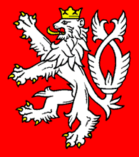
Crest of the Kingdom of Bohemia
Some Konechnes, Richard Hanson’s maternal grandparents family, considered themselves to be Bohemians not Czechs although many of their neighbors in Brule County SD referred to themselves as Czechs. Others were adamant that they were Americans and their ancestry was in the past. The Konechnes came from the region of the current Czech Republic that is known as Bohemia. The following is a very brief and incomplete history of Bohemia and its role in the present Czech Republic.
Bohemia is a historical region in central Europe occupying the western and middle thirds of the Czech Republic. The Czech Republic of Moravia was to the east, Austria to the South and Slovakia to the east of Moravia. Bohemia was circumscribed by mountain ranges known as Sumava, the Ore or Giant Mountains, and part of the Sudeten Mountains. The word Cesky refers to both Bohemian and Czech people in the Czech language.
The first settlers in the region were Celtic people and later the Slavic precursors of today’s Czechs. These Slavic people ruled Bohemia from the 10th century until Bohemia became an autonomous part of the Holy Roman Empire after joining with the Frankish Kingdom and The Carolingian Empire in a coalition. The Holy Roman Empire, which lasted nearly a millennium in the Germanic regions of Europe, reduced much of the population to serfdom with huge payments to the church for enrichment of the kings and church hierarchy. Kings of Bohemia ruled until the wars with the Hussites, who were followers of Jan Hus and Martin Luther.
Bohemia negotiated a freedom of religion compact in 1436. In 1720, Bohemian and Austrian Chancelleries were unified. At the beginning of the 19th century, Czech nationalism arose with support of the Bohemian aristocracy and the restoration of the Kingdoms historic rights with an official status for the Czech language, with a minority of Germans dissenting. The Austrians controlled much of the land in the western part of old Bohemia and the Bohemians were relegated to the status of serfs or poor landowners who were taxed heavily by the Austrian controlled government. During the 19th century, many of the Bohemians under Austrian control emigrated.
After World War I, Bohemia became the cornerstone of the newly formed country of Czechoslovakia. It became a rich and liberal democratic republic. In 1938, the western region of Bohemia then inhabited mostly by ethnic Germans was annexed to Germany as part of the Munich Agreement drafted by the Nazi party. Part of Bohemia occupied by Bohemians and Moravia were a protectorate under the domination of the Germans. Czechoslovakia was dissolved in 1993 and Bohemia became part of the Czech Republic. Prague which was part of the original part of Bohemia was a distinct region as were the Central Bohemian Region, Pilsen Region, Carlsbad Region, the Usi nad Labem Region, the Liberic Regions, Southern Bohemian region and three other lesser known regions. However, regions are still referred to as Bohemia and Moravia in tourist guides.
The Czech Republic was behind the Iron Curtain during the cold war period and was dominated by the communist party under the control of the Soviet Union. Industries were nationalized, Germans were expelled, and their land and property were confiscated by the State. Human rights were suppressed, dissidents were purged and the economy steadily declined. Alexander Dubcek became secretary of the Communist Party in the 1960s and instituted many reforms that gave Czechs greater political and cultural freedom. He attempted to create a more human form of socialism that would guarantee human rights and freedom from persecution. In August 1968, five Warsaw Pact member countries invaded Czechoslovakia because the freedoms threatened communist control of Warsaw Pact countries. The country was occupied until 1989. Russian perestroika, introduced by Gorbachev, in the mid-1980s marked the last years of communism in Czechoslovakia and the country was split into the Czech Republic and Slovakia. Vaclav Havel, a former dissident, was elected President and this period marked the end of Czech communist government. The period after the fall of the Berlin Wall is referred to as the Velvet Revolution. The Czech Republic is now part of the European Union.
We had a Czech scientific friend who visited us in Madison, WI and told terrible stories about the Russian and communist influence with many trials, imprisonments, executions and the Czech uprisings of the late 1960s and early 1970s. Vladimir Vinter had visited Madison for several weeks on two occasions. He disappeared behind the Iron Curtain after a trip to the U.S. Several attempts were made by scientific groups to locate him because he was a good scientist and friend to many U.S. and European scientists. The attempts were unsuccessful.
Bohemians are those people who inhabited or came from the region ruled as the Kingdom of Bohemia, which flourished under some good kings, and Christianity also grew strong. Some use it to refer to Bohemians as those who spoke the Bohemia language. Now it usually refers to those who came from the western part of the Czech Republic as opposed to Moravia in the eastern part of the Republic. The Konechnes came from a region near Prague, which was a dominant city in the Kingdom of Bohemia. They spoke Bohemian, but I do not know how it is distinguished from Czech as a language.
C. A BRIEF HISTORY OF EARLY IOWA INCLUDING DUBUQUE, MONROE AND IOWA COUNTIES.
The first city in what later became the State of Iowa was Dubuque. Lead, Zinc, and Iron Mines were operating in the late 1700s. Prior to that time, the Indians had mined for lead. Julian Dubuque filed a land claim entitled “the mines of Spain” in 1778. He is believed to have been the first white settler in Dubuque. The Fox Indians (Black Hawk in some sources, after chief Black Hawk) agreed to permit settlement in 6 million acres “sold” to the U.S. in territory West of the banks of the Mississippi in 1833, and lead mining and lumbering resulted in the rapid development of a prosperous city at Dubuque. Extension of the railroads to transport lumber from the North to the Mississippi caused a large increase in population and Dubuque was an important river port during the civil war. It later became an important meatpacking and manufacturing center. There are interesting pictures of its port operating during the Civil War on the Internet if one goes to Google and enters Dubuque Iowa. Dubuque had a fine theatre built in 1910 that still stands and operates. In its early history Eddie Cantor and Al Jolsen performed there according to a plaque on the building. An opera house was built about the same time and is still used in 2005, with restorations, of course. We could not get a cell phone connection while in Dubuque in 2005 so not everything is up to date. They do apparently have limited service using some providers.
Land known as the New Purchase was ceded to the United States in 1842 was considered to be one of the richest and most desirable regions of the country to be found in the Mississippi River valley. It was opened on May 1st, 1843, the time specified for the Indians to leave the area and move westward. For weeks and months prior to the 1st of May, the border was lined with encampments of setters and their families. The area was settled between midnight and sunrise on May 1st. The land had been laid off into counties, which were Wapello, Mahaska, Davis, Keokuk, Appanoose, Marion and Polk.
Iowa County, just west of Johnson County was occupied by Poweshiek’s band of Indian warriors who had their village in the county until the treaty of 1842. Iowa County was attached to Johnson County for judicial purposes. It was established as a county in 1844-1845. More about Iowa, Monroe and other relevant areas in this history can be found in sections on family histories.
The First Hansons, Glynns, and Bolands arrived in Iowa from Ireland before or about the time of Iowa Statehood in 1846. Doreothe and I have tried to learn the dates of arrival of each of our families and these dates are presented when known as part of each family's history.
The Bolands first settled in Dubuque about 1840, The Hansons in Troy, near what is now Williamsburg, Iowa County about 1844 and the Glynns in Georgetown, Monroe County about 1845. Mary Dolan’s family also settled near Dubuque. She was the daughter of John Dolan. Two other Dolan families were farmers on land adjacent to John’s.
Albia is about 75-100 miles Southwest of Dubuque and was part of a coal and mineral mining area. It is the county seat of Monroe County, Iowa. Albia had the first interurban railroad in the US in the late 1800s. It operated between the mines and Albia and on to a couple of other towns including Muscatine. The town square is beautifully restored. It has a very pleasant restaurant with good food on the square. It is restored in a hotel in the décor of 1900.
The first Glynns, including James Glynn, established land claims to the west near the settlement of Hiteman, which was near Georgetown in Guilford Township. Hiteman was a coal company town, owned by the coal company for some time. Georgetown developed as a small-unincorporated village about 5 miles west of Albia. Only St. Patrick's Church remains in Georgetown. St. Mary's church in Weller Township, where some Glynns, who were born later, lived, has been torn down but many present residents remember it and good pictures are available through the Monroe County Genealogical Society.
A son, Michael, was born to James and Bridget Glynn in 1853. Seven of Michael’s thirteen children were born near Georgetown. They migrated to Edgerton, SD., south of where Platte was founded in February 1899. Bridget Glynn is buried in St. Patrick's cemetery in Georgetown, Iowa. There are pictures of St. Patrick’s church and Bridget’s gravestone in the Glynn family picture albums we have completed.
Spillville is a small town (population in 2004 of 384) in Northeastern Iowa. It is located in Winneshiek County. It is a town settled by Bohemian immigrants and boasts a strong cultural and musical history. Antonin Dvorak, the world famous Czech composer, spent the summer of 1893 there when he composed two of his most famous chamber works, including String Quartet in F. There is a statue of Dvorak in the town. The town has a ballroom started in 1920 that hosted Louis Armstrong and Guy Lombardo in the 1920s and 1930s as well as local musical groups. St. Wenceslas church, shown in the Konechne photo album, was built in 1860 and remains the Roman Catholic parish. It is the oldest Czech Catholic Church in America and had the oldest Czech parochial school in America as well. The town has retained its Czech and German heritage to the present and holds Czech days in July (RAGBRAI). It is said to be the most historic and scenic Czech village in America. Well-known Czech clock makers established a shop in the town. The Bily Clockworks were well known for their old world standing clocks that were intricately carved and finished. It is now a museum.
Winneshiek County was named for a Winnebago Indian Chief. The first permanent white settlers arrived in Winneshiek County in 1848. The county seat is Decorah and has a 2004 population of about 21,200. Jan F and Marie Konecny and their family arrived in America in 1869, and first settled in Spillville, an established Bohemian community of farmers. They moved to Brule County SD in 1882 and homesteaded in what became Richland Township, Brule County just to the north of Charles Mix County. The proximity of the counties accounts for the acquaintance of Walter Hanson and Mayme Konechne before they married. We understand that they met at dances in Bendon and Kimball on several occasions. Dad accompanied his sisters Rose and Agnes and a friend to some of the dances according to Aunt Rose and a friend of hers, Ms. Rena Dietz. Rena was a next-door neighbor of Doreothe’s family when she grew up and was also a friend of Richard’s mother.
D. A BRIEF HISTORY OF SOUTH DAKOTA INCLUDING CHARLES MIX AND BRULE COUNTIES.
Most of the information in this part of our history was obtained from the Epic of the Great Exodus, a history of Charles Mix County South Dakota and The History of Czechs in South Dakota. These books contain many pictures of the early villages and scenes in South Dakota. The Epic book was compiled and edited by Adeline S. Gnirk at the request of the Charles Mix County genealogical society. My history is much briefer and is written because not all interested in the histories of the Hanson’s, Glynns, Bolands, Flynns, Landsbergers and Konechnes will have access to the book of 635 pages. I have copied a map from this book showing the settlements described below, as they existed in 1878-1900. Most of those did not exist except for some foundations when I was young.
The U.S. government purchased the Louisiana territory from France in 1803 and Lewis and Clark passed through in 1804. They paused at a trading post established in 1794 by two fur traders and trapper, John Baptist Trudeau and Regious Loisel of St. Louis. These two traders and 5 men sent by the Missouri Fur Company erected log forts on the bluffs near what became Wheeler about 11 miles south of where Platte is now. The Louis and Clark expedition spent a night on Cedar Island and enjoyed two hot springs on the island during their stop. This area was part of what was known as the Great American Desert on their maps. Many years later, the land along the Missouri river was opened for settlement. Dakota territory, separated from the Nebraska Territory, was established in 1861 as a result of a treaty with the Sioux under Chief Strikes-the-Ree.
Dakota Territory had previously been part of the Northwest Territories, which were part of the Louisiana Purchase. Land, excluding the Yankton Sioux Reservation, was opened for settlement but closed again by President Grant in 1871. The Yankton Sioux occupied a reservation on the eastern half of Charles Mix County and the western half was opened for settlement again in 1879. The Bureau of Indian affairs decided to deed each member of the Yankton Sioux 160 acres on the reservation. The Indians had no concept of land ownership and in fact the idea was foreign and repugnant to them. They were very easily talked into selling the land for little to nothing by unscrupulous whites because ownership by anyone was not a meaningful concept to them and the government did not intervene. The poor Sioux who originally were southeastern Indians were forced to migrate ahead of settlement and finally displaced the Arikaras on the plains of the Dakotas about 1800. Their life on the plains has been briefer than most realize. How they grew to be such a powerful nation (The Lakota) is a very interesting historical story.
The county was named for Captain Charles Mix, an early commissioner of Indian affairs on the Yankton Sioux Reservation. He was slain in an encounter with the Sioux. Wheeler was made the first county seat. Brule County to the north was separated from Charles Mix County and had been opened for settlement in 1875. Bijou Hills, a stage stop, was established in what became Brule County and was 5 miles northwest of where Academy, the village that I grew up in, was later located.
Statehood was simultaneously granted to North Dakota and South Dakota, which comprised Dakota Territories in 1889 after a long congressional debate about whether there would be one or two Dakotas.
Many people who came to settle were like the Bolands, Flynns, Konechnes, Hansons and Glynns who were drawn to free land and to escape the development in Iowa and eastern Minnesota and other settled areas to the east. A few quotes from notable authors may be in order here to demonstrate the hardships they endured.
Some of the quotes below were found in John R. Milton’s book, South Dakota, A history listed in the addendum.
O. E. Rolvaag, in the English translation of his book Giants in the Earth wrote in the opening paragraph of the novel “Bright clear sky over the plain so wide that the rim of the heavens cut down on it around the entire horizon.” In this novel, he emphasized the unending prairies when settlers left Minnesota to cross the Great Plains on their westward treks to central South Dakota. There were no trees, bushes, or large structures to hide behind for cover or privacy. Interestingly, they saw no animals like prairie dogs, rabbits, coyotes, or even insects except a few mosquitoes on their trek from Sioux Falls or when they arrived after 4 days 52 miles west of the city. Travelers near the Missouri further south and west found abundant game and an abundance of diversity and numbers of animals as described later. Proximity to bodies of water was probably the reason for the differences. The settlers in Rolvaag’s book were located between the James and Sioux rivers, one of the areas with the least numbers of hills and valleys.
Eric Severeid wrote of early South Dakota “It was a trial of the human spirit just to live there.” Moses Armstrong, a territorial delegate to congress, described the fertile soil and quality of the grazing land while he pleaded for railroads and statehood because the towns were isolated and marketing was difficult. He said “many homesteaders dreaded a lonely exile and would almost as soon homestead the moon as pick a place on the green prairies of the west thirty miles from a tree.” In general the landscape terrified many who traveled through. There was more flat land, more sky, more wind and weather, than they had seen before. Nothing blocked the wind. Their terror was fortified by intense thunderstorms, summer heat, isolation from other inhabitants, and winter blizzards. The sameness of the landscape seemed endless to many and stretched on forever to the artic in the north and the mountains in the west.
In his novel Big Rock Candy Mountain Wallace Stegner wrote about “the lack of trees, farms scattered, few hills, turgidly flowing rivers, sod shanties, unpainted shacks, windmills, nondescript cattle with cowbirds sitting on their hipbones, wind-the wind kept you tense all the time" and later he wrote of the heat and blizzards. The extremes in climate impressed several writers. This book gives a rather distorted view of the prairie because there were buttes, valleys that creeks or rivers ran through and many features left by the receding glaciers in northern and central South Dakota. However from a high point in the landscape the view was very long.
Fredrick Manfred describes the dust bowl days after much of the settlement occurred in the book The Golden Bowl. The earth drying up and blowing away, the intense poverty causing people to struggle to stay alive caused a great exodus to the west and south by many Dakotans.
Ernest Haycox wrote of the time of Custer in Bugles in the Afternoon. His book contained descriptions of early railroad towns as follows; “the railroads that gave the town a single pulse beat once a day came as a black ribbon out of emptiness.” Others wrote of the towns containing buildings bare as boxes dropped on a treeless landscape, flimsy wooden sheds, grasshoppers, grasshoppers everywhere, which produced a picture of sterile poverty to the eastern traveler.
Rolvaag in his book Giants in the Earth described the starkness, dinginess and hopelessness of the existence on the prairies for many settlers. It has been a very popular novel describing the hardships of frontier living. It led to the feeling among people in more populated states that the Dakotas were desolate and remote as a foreign country. His two subsequent novels also painted a bleak picture of the problems involved in the evolution of social and political structures in the Great Plains.
Thomas Brokaw provided a description of his young life on the bluffs of the Missouri in Yankton and near where the Fort Randall dam that was under construction in the early 1950s. It is worth reading from the point of view of a person who left South Dakota and became a very successful newscaster. Irene Glynn, Doreothe’s sister, was a babysitter for Tom Brokaw, the well know TV newsman, when he was young and she was a nurse in Pickstown, the town developed to support construction of the dam. Tom is a bit younger than Doreothe and I so his perspective was from a place a few miles from Platte and time similar to ours. He described the hard backbreaking work endured by his father and his contemporaries to earn a decent wage in the 1950s.
The winters of 1880, 1886, 1887, and the blizzard of 1888 often referred to as The Children’s Blizzard from the book of that name by David Laskin killed many people including two people staying at Novotny’s farm and Bouzas who were relatives of the Konechnes. Joe Bouza, who was the Registrar of Deeds in Charles Mix County when I was a child and until the 1990s, was a cousin of my mother Mayme Konechne Hanson. I believe his aunt perished in the storm. She was transporting a load of hogs to market with her young brother following in another wagon. She went for help and perished. Her brother crawled into a wagon with the hogs and survived. These biographies were presented in The History of Czech’s in South Dakota. Novotny was a well-known name in Kimball. These winters were followed by a drought in the Dakotas and maybe other states as well that lasted until 1895. Many large and small farms and ranches failed. The rains returned in 1895 and the farmers prospered for many years (See The History of the Czech’s in SD in the book cited in the addendum to this history. This part of the country was repopulated after 1895 when new settlers arrived to buy up the cheap land vacated by former homesteaders or to homestead in unpopulated areas. Among them were my forefathers, the Konechnes.
The hard times of the 1930s caused an exodus that resulted in a great decrease in population in most counties and cities. Many counties did not recover their population as farms became larger and larger when better times came. For example, Charles Mix County had a population of 16,700 in 1930, 11,785 in 1960, and 9,350 in 2000. The decrease is continuing in central South Dakota now as roads improve and mechanization allows farmers to farm larger acreages with less personal labor. An issue of the South Dakota Magazine, which was published in February 2005, stated that Harding County in northwest SD has twice the area of Rhode Island but a population of only 1200.
Why did our ancestors, like the Konechnes manage to gain a foothold while many more left because they could not endure the hardships? They settled in communities of people much like them in religion, culture and interests and through mutual assistance and support managed to make it through the hard years. Their neighbors endured the hardships with them and they cooperated to survive. Many, but not all, that survived the first period after settlement was initiated, left during the drought and depression. The Konechnes and many other Bohemians and Czechs in Brule County did not leave during the great depression and drought but stayed and prospered when the good years and rain returned in the 1940s. Two brothers, Leo and Lewis Konechne left for Milwaukee to pursue education and professions other than farming but the remainder of the brothers (Charles, Paul, Harry, and George) and sisters Elsie and Lucille remained and farmed in Brule County and my mother was just to the South in Charles Mix County. Helen married Orley Lynch and they moved to Elk Point in eastern SD where they also farmed. Their children still own the farms and some children have expanded their land holdings greatly.
When we visited Academy in 1996 after my Mother’s funeral, we observed workers digging ditches along the state highway through what remained of the village. The purpose of the trenches was to install fiber optic cable to farms and small towns in the area. These people are in good contact with the outside world and can no longer be referred to as hick farmers. Sioux Falls became a business center because of laws that gave favorable treatment to companies including credit card companies that charged high interest rates for unpaid balances in accounts. These rates are higher than allowed in most other states. Labor unions did not gain a foothold in the state and wages are relatively low. Rapid city became a center of tourism and mining. South Dakota does not have a state income tax and has a favorable tax structure for some businesses. Their public services and school budgets suffered as a consequence.
Despite claims to the contrary, SD does lack the cultural amenities of cities like Minneapolis and Madison, WI where Doreothe and I have lived and I think that the medical facilities are not as good as in the two cities mentioned. Sioux falls now has a population of about 130,000 and is isolated from other urban centers. It is not a large city that draws the best service professionals. However, South Dakota is trying hard with some success to bring theatre, art, and musical entertainment to some areas. Many smaller towns are slowly deteriorating in terms of upkeep of buildings and loss of population. The good highways and poor opportunities for the young have doomed them to loss of trade and their children.
South Dakota has since early settlement been culturally divided into East River and West River. In part, this is geography or geology that led to cultural differences because of the land use practices in the two parts of the state. The topsoil is deeper east of the river, there were fewer rocks to pick when farming, and the rainfall is more dependable and abundant in the East River areas. The soil in the East River areas is more suitable to agriculture. The difference in rocks when plowing impressed me most. West River is mostly suited for ranching and has some of the most desolate land with the two large Indian reservations of Rosebud (Brule Teton Sioux), Pine Ridge (Ogallala Teton Sioux), and Fort Thompson in southern South Dakota and Standing Rock Reservation (Hunkpapa Teton Sioux) in the north (see footnote at the end of this section). West River is usually considered the part of the west culturally with cowboys, ranch towns, mining and the Black Hills. The dress is characteristically western in West River small towns with the Stetson or other wide brimmed hats, the jeans and cowboy boots. This culture is promoted to tourists west of the river and to a lesser extent east of the river. Most East River farmers wear the caps with machine or seed dealer logos, and shoes or boots other than cowboy boots and businessmen often dress in suits or casual business attire. The east river farmer often has the characteristic farmers tan with a white forehead and dark tanned lower face and neck.
Bonesteel, a town in the West River country just west of the Missouri and near the Nebraska border, serves to illustrate the East River/West River differences during settlement. It was established in 1892. It was established on a 40-acre part of a military reserve on the Rosebud Indian Reservation. The town was originally named Huston but then renamed after Henry Bonesteel, a philanthropist from a wealthy eastern family and a State Senator from Nebraska. He also owned a large trading post on the Niobrara River. The town was the gateway to the vast Rosebud and was so advertised for some time. There was agitation for opening the territory to the west in the Rosebud for settlement and conquest. The vast Indian lands were shrinking. Twenty six hundred 160-acre lots in what is now Gregory County were given away by lottery. Bonesteel was declared a wide-open town and the vice syndicates, the underworld bosses, and gangsters approved Bonesteel as a bastion of the Western League with Deadwood. Trains arrived every day with underworld representatives and money and the town grew dramatically. The town was filled to capacity with even the alleys filled with tents. Crowds were said to have milled back and forth and there was much evil and wickedness. The town was open day and night with much high stakes gambling, tent shows, burlesque shows, bawdy houses, prostitution, and squawkers calling loudly all over. Hordes of undesirable people were said to be in the town because it was speculated that there would be a big land rush to the Rosebud. Women lived in fear of assault. On July 20, 1904, the original inhabitants of the town rebelled. The citizens arose en masse with armed policemen marching down Main Street and stopping at every swindlers joint and asking people if they had reason to be there. Some gamblers demanded hearings and others simply fled. Six did not survive the indignation of the vigilantes and police. A judge listened to many complaints by those “arrested” and sentenced them as vagrants and ordered all out of town by nightfall. A train was waiting to take them away. This event became known as the Battle of Bonesteel.
Bonesteel became a respectable town after the loss of prosperity brought about by the expelling the criminal element and the town became a respectable West River place of commerce. The Rosebud suffered further encroachment but still occupies a large area of land west of Gregory County.
Information for this article was obtained from a history of Gregory County compiled by Alaine Gnirk, the same person responsible for The Epic of the Great Exodus.
The discovery of gold in the Black Hills and the gold rush in the period of 1873-76 led to development of notorious towns like Deadwood and Lead with Wild Bill Hickock, Calamity Jane, Buffalo Bill Cody and many other gunmen, outlaws and famous lawmen and others in residence.
The Indians who had received sole rights to the Black Hills by treaty were forced out by a congress, which felt that the land should go to those who would use it for the greatest profit to the nation. The Indians were thought of as a curse by most of the white population and this feeling persisted into the 1960s.
Charles Mix County was an East River County bordered on the west by the Missouri and had some of the flavor of both cultures.
William and Mary Boland were the first of our relatives to settle Charles Mix County in 1883. William was a steamboat captain on the Missouri who took some of Custer’s troops and supplies to the confluence of the Little Big Horn River before the massacre and ferried dependents on long trips upriver to forts that protected settlers after Custer’s Last Stand. He had passed Charles Mix County several times before settlement was permitted in 1883. John Boland, his nephew, is the grandfather of Mary Lou (Hanson) Kollar. He may have been on the same trips as William. On one of these trips he, William Boland, filed for homestead under the preemption act which allowed for rights to 160 acres of land for $1.25 and acre prior to filing for a homestead. A person or family member had to pay the $200 within 6 months of filing and occupy the land at least one night a month for 5 years. Then a homestead patent claim was issued at some time later. William Boland’s patent was issued in 1891. I have a copy of his preemption filing documents and his homestead patent as well as those of John Boland and his wife Mary. The Flynns and Glynns also filed for homesteads in Charles Mix County. Michael Glynn’s patent was issued in 1911, which means he had filed at least 5 years earlier. He had previously purchased land in Hamilton Township in 1889. James Flynn, Doreothe’s great grandfather filed a preemption claim in what became Castalia Township in 1884.
When Mary Boland and her family first arrived in Castalia Township, Charles Mix County, SD in late June of 1883, there was just unimproved prairie with grass as far as one could see. Sod houses and dugouts far outnumbered the frame houses and the only roads were Indian trails and a government wagon trail for several years. There were no suitable trees for log construction. Their sources of water were the Missouri river and creeks. The nearest railroad was Kimball about 50 miles to the north. The settlers were so busy getting the farms started and many did not have the money to buy lumber for frame homes until the land was cultivated and producing crops. The home of William and Mary Boland was partly constructed because William Boland had lumber shipped ahead and had arranged for construction of the home. J.P. Boland also settled there and became postmaster at Castalia while William continued to captain steamboats on the Missouri and Mississippi Rivers to provide funds for the start of the farm operation. John Edmund Boland, a nephew of William Boland, was also an impressive Missouri river boatman who filed a homestead and later owned a saloon and store in Castalia. There is more written about the Bolands later in this history. They were a remarkable family.
Stephen J. Hanson, my grandfather, arrived in South Dakota from Iowa in 1903 with my father, Walter, and my father’s sisters Margaret, Juliana, and Catherine and his brothers Mervin and Leonard. They first settled in Castalia Township.
It is interesting to put these events in the context of other events generally known to many persons. The Sioux and their allies defeated Custer in June 1876, a century after signing of the Declaration of Independence. He had camped on the Missouri in Charles Mix County in 1873 on his way to the Black Hills to explore for gold. The Battle at Wounded Knee, as it was known by the whites, or the massacre at Wounded Knee was said to be the last great battle between the whites and Native Americans. Of course, it was no battle. The slaughter of the Ogallala Sioux on the Pine Ridge Reservation in December 1890 was partly in response to the religious fervor of the Indians including the ghost dancers some of whom felt they were immune to the white soldiers bullets. The Rosebud reservation was across the Missouri river west of where Platte was founded in 1900 and the Pine Ridge reservation was adjacent and just west of it.
Some of our forefathers arrived shortly after the Indian Wars that opened land in Iowa and some were in South Dakota before the massacre at Wounded Knee. Most settled near the Missouri River except for the Konechnes in Brule County.
South Dakota became a State in 1889. This is the time that the South Dakota frontier was considered to be closed and the state developed with a political organization that largely responded to Eastern SD interests. Western SD was independent and much less populated if the Indians were not counted. The population of the state decreased in the early 1930s and never recovered except for the number of Indians. In 1988 there were over 30,000 Indians in the state. Most lived in the southwestern part of the state on the poorest land available. They were doomed to poverty.
The great depression had a great impact on population and the depression and drought were causes of much of the migration. The depression ended in about 1941 in central South Dakota.
To me, the incredible beauty of this part of our country can be viewed in some of its diversity by driving from Platte to Winner over the bridge that crosses the Missouri west of Platte soon after sunrise on a summer, spring or fall morning.
We traveled this area, leaving Platte after midnight in the mid 1960s on our way to California and felt some of what early settlers did. We did not see but a couple of lights for hours from a town, a farm, a car, or dwelling of any kind west of Winner and on into western Nebraska and eastern Colorado. In the process, we went across the Rosebud and part of the Pine Ridge reservations and into the ranch country of the other states. The feeling is one of isolation and helplessness in the event of some tragedy.
a. Footnote: The Great Sioux or Lakota Indian Nation is composed of seven tribes or council fires with some shared customs. They are the Teton (the largest and most powerful), Mdewakaton, Wakpekue, Wahpeton, Sisseton, Yankton, and Yanktonai. The Teton have seven groups: The Ogallala (chiefs Sitting Bull and Crazy Horse), Brule, Two Kettles, Sans Arc, Blackfeet, Hunkpapa, and Miniconjou. Teton Lakota people also live in Wyoming, Nebraska, Minnesota, and Canada.
E. SOME EARLY TOWNS AND VILLAGES IN SOUTH CENTRAL SOUTH DAKOTA.
Bijou Hills is included in this history because it was an important village to me. Some of my childhood and high school friends lived in or near the village. It had a saloon and grocery store when I was young. The saloon was owned by the Houska family and was frequented by many farmers within a 10-mile radius. None of the Hansons settled there but it was only 5 miles northwest of academy, 1/2 mile north of the Charles Mix/Brule County line, in Eagle Township. The township was named for the Eagle nests that were common on the Bijou Hills that extended from 6 miles east of the village of Bijou Hills to the Missouri river bluffs about 5 miles west of the village. Eagle Township was south of Richland Township in Brule County where many of the Konechnes lived and where my mother was born and was raised.
An explorer, Perrin Du Lac, visited the hills in 1801 and left a monument of cedar there. Antoine Bijou established a trading post there in 1812. A settlement started in 1869 when another trading post/roadhouse was built on the Missouri river trail, a military road from St. Louis to points upriver. There were sheds and feed for horses and the wife of the proprietor was said to be a good cook who provided meals. A post office was operational in 1873 and mail and freight were carried from Bijou Hills to the Rosebud agency across the river by ferry and on to the Black Hills.
A ferry operated west of Bijou Hills and the settlement became a stage and freight wagon stop for more than one stage line. A hotel was built when the town was platted in 1882 and the village grew with a large hall, where speakers came from long distances to entertain. A newspaper was printed and a mercantile company owned by Julian Twing who later started a bank was established. I knew Julian Twing who was retired in Bijou Hills when I was a child. He had an adopted son who became a notorious murderer and held a distant female relative of mine hostage for a day before surrendering. The village had a creamery and egg station with an ice cream parlor, a telegraph office, millinery shop, pool parlor, barbershop, hardware store, blacksmith shop and garage, harness and shoe repair shop, a building contactor, and dance hall as time went on. All but a store, an abandoned bank that failed in the depression and the pool hall (saloon) were gone when I was a child in the early 1940s.
The aged grandmother of two childhood friends, the Lloyd Graves boys, lived with the family at the foot of the hills about a mile southeast of the village. She had seen or met Sitting Bull, Crazy Horse, and other Teton Sioux war chiefs on their migrations between the Yankton reservation and the Black Hills region. The Bijou Hills were very important to the Lakota Sioux and were frequent sites of Smithsonian archeological digs by men who camped in tents in Academy when I was a child. We would talk to them about their work in the evenings during their summer visits. We found arrowheads and other Indian artifacts during our explorations but most have been lost over time. I still have some plus a very large stone horse anchor whose function was difficult to determine by other collectors until it was finally found described in an artifact magazine by a friend of mine.
We would pick my grandfather up at one of my uncle’s after mass once a month at Bendon church northeast of Bijou Hills and take him to the pool hall there after lunch. He would swap stories with other old timers for a couple of hours and we would return him to one of my uncles near Bendon and he would return to his home in Kimball in the afternoons.
Academy, the village where I was raised, was first incorporated in 1898. It was located in the Northwestern part of Charles Mix County, 1 mile east of Snake creek, 5 miles from where Snake Creek joined the Missouri River and the ferry crossed the river. Reverend Camfield, who was Congregational pastor at the village of Colvin, proposed the construction of a school and William Burton and Ephraim Miner donated 40 acres of land in LaRoche Township and money was collected for the construction of Ward Hall, the first building. Ward Hall, a two story building, was dedicated in 1893. School opened with 22 pupils in that year and the Camfields moved into the building. A creamery and newly built store owned by John Lloyd opened in Academy by1899. Lumber was transported from Kimball some 33 miles away, which was also the nearest rail terminal. A post office was transferred to Academy in that year. The Congregational church, the last building left in Colvin, was moved to Academy, and still stands and serves a congregation in 2008. It was later added onto to give the present structure. It was and is the site of many community gatherings including oyster boils when I was young. The town and school grew, attracting students from great distances and Warren Hall, a 5-story building with classrooms, girl’s dormitory, dining room, a beautiful music room, office, classrooms, a room for a nurse, rooms for teachers, and an apartment for the head of the school. Camfields built a parsonage associated with the church in the village about ½ mile from the school. The school also worked a 35-acre farm to produce food for the dining room and a barn and other outbuildings for several horses, pigs, sheep, chickens, and cattle. A boy’s dormitory was built on the main street of Academy, a blacksmith shop was one of the first enterprises and about 10 homes were built. When I was a child, the village had a grade school, a post office with an attached two story residence for the postmaster and her daughter, the original store still operated by John Lloyd (with some of the original merchandise), the blacksmith shop which also was a car repair shop operated by the blacksmiths son, an ice house for storage of large blocks of ice cut from Academy lake in the winter, and 5 residences. Warren Hall was still standing and served as a county poor farm. It had a few families in residence when I was a child. Children from the poor farm attended the country school that Dwight, Theresa, and I did. A visiting nurse used Ward Hall at the poor farm during visits to Academy. Children were vaccinated or checked and treated for illnesses. I remember one occasion where we had to be checked for immunity to diphtheria because of a case or two in the area.
I thoroughly enjoyed watching the blacksmith, Ed Pasek work with the forge, hammers, and anvil to make various tools, plowshares, and replacement parts for grain binders and other equipment. We had much room to roam and would walk 2 miles to Academy Lake to fish and swim. Academy Lake is a dam constructed on Snake Creek by the WPA workers in the 1930s. It had a nice small park for picnics and a bathhouse. We would walk (usually barefoot in good weather) 3-4 miles to visit friends on farms. We hunted pheasants every evening in season, geese and ducks in season (and sometimes out of it), trapped muskrats, and shot or trapped rabbits for fur to get spending money. I tried without success to trap mink and beaver. They were plentiful on the creek but difficult for me to trap.
We visited neighbors a great deal and walked to school (about 1/2 mile west) when it was in session. In thinking back, it was a fairly good life although without electricity, running water or telephones. We had a 6-volt car battery operated radio to listen to a few programs and the news. We were allowed about 30 minutes to listen to Jack Armstrong and The Lone Ranger before or after chores. This limit was imposed to conserve the battery charge. The battery was charged on Saturday afternoon shopping trips to Platte (along with visiting) and trading eggs or prepared spring fry chickens for the few groceries we needed.
Castalia: Castalia Township was where the Hansons, Bolands, and Flynns first arrived in South Dakota. The town was first established in 1882 as the town of Franklin, on what was the Pranger homestead. It was renamed Castalia. The first resident, a blacksmith, had arrived in 1879. A store, hotel, and post office were quickly established. Four saloons were said to be going day and night. Fistfights and gunplay were said to be frequent late at night. The town was located seven and 1/2 miles from the Missouri river where a number of roads converged to make it an important trade center. Steamboats went up and down the river bringing mail and supplies. A stagecoach arrived from Chamberlain via Bijou Hills three times a week. Ferryboats brought livestock and people from across the river and it became a banking, trade, and postal center with a population of 300 by 1893. The school had 55 students. By then the town had a newspaper, a doctor, two blacksmith shops, a drug store, two general merchandise stores, two millinery shops and a Catholic and a Methodist church. The Bolands, Flynns and Glynns attended the Catholic Church, St. Ann’s. The only other Catholic Church anywhere near was at Bendon in Brule County where the Konechnes lived and was about 40 miles north, 5 miles NE of Bijou Hills. John E. Boland owned a saloon in Castalia and had a large house and barn on a working ranch nearby. J.P. Boland was the postmaster. When the railroad arrived at the site where Platte would be founded, Castalia was moved nearly to the last building to the railhead. The movement of some buildings required 76 horses. The feat of getting them all to pull together in the right direction is hard for me to imagine. They had to move across Platte Creek and through draws without roads.
The area had antelope, wolves, coyotes, bobcats and many other animals when settlers arrived. Several except the coyotes, skunks, badgers, prairie dogs, jackrabbits and smaller animals that could tolerate farming and human habitation have disappeared from the area with development. The rattlesnakes seem to have survived well.
Edgerton is mentioned because it was in Hamilton Township, the township that the Michael and Anna Landsberger Glynn and their family first settled in SD in 1898. Michael and Anna were Doreothe’s grandparents. The town was first platted in 1885 just southeast of Castalia about 5 miles. It was located on a meadow between deep ravines to the north and south. It grew in population and businesses for a short period but nearly all the business buildings including the hotel, general store, law office, Evangelical Lutheran Church and residences were moved to Platte when the railroad came in 1900.
Platte became the town that the Hansons, Glynns and their relatives all depended on for trade, church, and school. There were several country schools in areas extending about 25 miles from Platte that served grades 1-8 for farm, ranch and other children including Richard, Dwight and Theresa Hanson. Children in the country schools went to Platte for high school. Helena Glynn taught in country schools for several years. All the Hansons, except the Walter Hanson family, left the area in the 1930s or moved to Platte. At the end of the 1930s only Walter of the living Hanson children remained in SD. The others scattered to Texas (Agnes), New Mexico (Helen), and California (Leonard, Juliana, Catherine, and George). Stephen lived with his brother Mervin Hanson’s family until he graduated from high school, and then went to Texas to live with his sister Agnes. Agnes was a pharmacist and agreed to send Stephen to Oklahoma State University to pharmacy school according to the information told to me. He was in the medical corps in the Pacific during WWII and joined other Hanson siblings in California after the war. Margaret died of tuberculosis in Santor, SD. Mervin died in Platte on December 15, 1935.
Platte, named after Platte creek, was misnamed because Platte creek was named after a man named Pratte and a letter somehow got changed through misreading or some other error when the documents for incorporation were filed. It got its start when the Chicago, Milwaukee, and St. Paul Company secured the right away across the Yankton Sioux reservation in eastern SD. It was extended from Sioux City, IA then to Armour and finally as far as Platte. Charles Mix County was one of the last counties in South Dakota to get rail service partly because it was enclosed by Indian reservations, I think. The farmers were at a great disadvantage compared to farmers nearer the railroad because they paid much more to ship products like grain and livestock, mostly by steamboat from Wheeler or by freighting to the train in Kimball about 45-50 miles away by horse or oxen drawn wagons. After the railroad right-aways were secured, construction began immediately and lots were laid out and sold in March of 1900 in Wagner, Geddes and Platte by the railroad company. The rails reached Platte and the first train arrived on October 16, 1900. Platte was settled in buildings moved from Castalia, Edgerton, Wheeler and other towns and villages that disappeared. The steamboats, that were put out of business almost immediately. The colorful history of Platte is well described and documented by photographs in the Epic of The Great Exodus. The history of the city is followed by the histories of families that lived in the area. I will not repeat here much of the information that is so well presented in that book which is available for $25.00 from Elaine Gnirk in Gregory, SD.
Brule County was first settled by white people in 1872, at Brule City on the Missouri River about 10 miles South of where Chamberlain now is located. Brule City was the first county seat when the County was organized. John Houska born in Klicky, Bohemia in 1839 and a few other Bohemians were the first residents. Individuals or their families known to me were the John Vodrazka family (he was born in Sobeslav, Bohemia in 1826 and I knew his son) and the Novak families, The Houska families, Victor Nepodal, John Pipal, Joseph Korzan, and Joseph Duba. The Czech Farmers Mutual Insurance Society that insured farmers against fire, lightning and events that destroyed buildings, crops or animals was established in 1895. Ed Pasek was then a blacksmith in Academy in Charles Mix County and Joseph Forman had a general store in Eagle, Vaclav Houda, father of my uncle Fred Houda, was a cashier in the Kimball bank directed by Victor Nepodal and John Talich. Although Brule City did not exist when I was a child, these latter persons were all known to me.
The Paseks were our neighbors and Ed was still blacksmithing when I was a young boy in Academy. The crops were good for the first few years after 1885 and those that became established survived the blizzards, as well as the drought and grasshoppers that came in the late 1880s and 1890s while those that were not on their feet financially failed because money was tight and interest rates were as high as 12-50% in the absence of usury laws. They lost the land they homesteaded when they had to borrow money to buy merchandise. There was a mass abandonment of the land around 1890-1894 because of the winters of 86-87, the great blizzards around 1888-1890 and the drought that followed. Rain returned soon after 1895 and the county was reinhabited. Residents drilled artesian wells in townships and drainage lines that were dug co-operatively and were used to disperse water. Some had to travel several miles for water.
Bendon was a small village with a Catholic Church (Holy Trinity), rectory, dance hall, general store, saloon, and post office. The village was named after J.L. Benda after whom the post office was first named. His son and daughter-in-law were great friends of our family and I admired and respected Mrs. Benda very much. I visited with her often when she later was widowed and lived in Platte while I was in high school. She was one of the kindest people I knew at the time.
Holy Trinity Church at Bendon was built 1894 and a rectory was built in 1899 at Bendon in order to attract a Czech priest. St. Margaret’s Catholic Church, a really grand church for the area in my estimation, was built in Kimball in 1895, 14 miles northeast of Bendon. St. Margaret’s served several nationalities unlike Holy Trinity that served a Czech congregation for the most part with services in Latin and Bohemian. The Konechnes were participants in the building of Holy Trinity. A Presbyterian church was built in Eagle about 3 miles southwest of Bendon and 6 miles north of Academy. There were 180 Czech families living in Brule County in 1915 and all seemed to be doing well. They retained their Bohemian or Czech heritage including the language. Many intermarried and it is not surprising that I am related through my mother to many of the residents who lived there from 1930 to the present. I, my cousins, my father and other spouses who were educated in English and could not speak bohemian, were off by ourselves at Konechne/Soulek family picnics.
I relied heavily on information in the book Dejiny Cechuv ve stratu, South Dakota (History of the Czechs in South Dakota); this book was compiled by Joseph Dvorak of tabor in 1920 and translated into English by Laddie Kostel in 1980. Like the epic books written for Charles Mix County it is a marvelous reference as well as great entertainment and a source of education. A copy was given to me as a present by my aunt Lucille Konechne Houda who has written about the history of the Konechnes and Bohemians in Brule County. I think she felt it important for me to remember my Bohemian heritage and I appreciate her concern.
My great grandfather, John F. Konechne, wrote a report about Holy Trinity church that was reproduced in this book. Part of this report is presented below.
“We had to go through a lot and suffer before we experienced a tolerable living. Those were hard times, when it was necessary to wait two years before the field was plowed and the second year we planted. There was hardly any income and expenses were constant. Many a settler came here with some money, with a team and when he bought a pair of oxen for $90, he thought he was the richest man in America. We made ourselves a drag and with that traveled 12-16 miles for a sack of flour, and this is how we traveled two and as much as three years before some of us could buy a wagon. Now everyone has money he himself does not even know and consequently does not know his worth, but I judge that he is worth nothing. And what is the reason? When he had nothing, he was satisfied. Nowadays many of those settlers have absolutely no money for a good cause but for motion pictures and expensive autos everyone has plenty of money.”
The winters of the 1880s and the big blizzard of 1888 had a great toll on animals and people. Many people died in blizzards, some who left their houses to go to outbuildings and others who were caught away from home. These winters and the people who died, some of them were my mothers relatives, are described in the book The History of The Czechs in South Dakota, published in 1920 and The Children’s Blizzard.
To summarize life on the central plains and particularly the Dakotas during settlement, we point out the following hardships. There was uncertain weather all the time. Blizzards, heat, drought, crop failures, grasshoppers, loneliness, and a separation from ancestral families were among the hardships. One need only look at the period of 1880-1900 to see how difficult times were for the pioneers. It was very difficult to break sod to get the ground in condition for planting. The advent of the sod breaking plowshare helped a great deal but the grass roots formed a meshwork in soil that was very hard to break up and get into condition for planting. It was hard work with no short cut. Then the blizzards came regularly culminating with the blizzard of 1888 that wiped out much of the livestock and many people died. Next came years of drought from 89-95 and the depression of 1893. Farm income dipped steadily until the price of corn was half in 1890 of the price in 1870. The rains returned in 1895, but 60% of the pioneer families had abandoned their homesteads. Some settlers came back and some regions were repopulated to some extent. Many again were frozen out or blown away and the great depression took another toll and caused another exodus. I mentioned in other parts of this history that the loss of population has continued into present times but for different reasons now in most places. Yet, many of the regions remain unpopulated and poor in the Dakotas and Nebraska in particular where the majority of the countries’ poorest counties are. The Native American Population, which is very poor, has nearly the same population now as in 1860 and buffalo are increasing in numbers on unpopulated lands as well.
Only the hardiest and most committed of the early settlers stayed to produce four generations of descendants up to this time.