 |
 |
What's
New | Bios | Birth/Marr/Death | Cemeteries | Census | Courts | Directories/Lists | Families | History
| Maps | Military | Photos | Resources | Schools
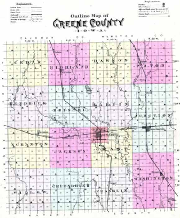
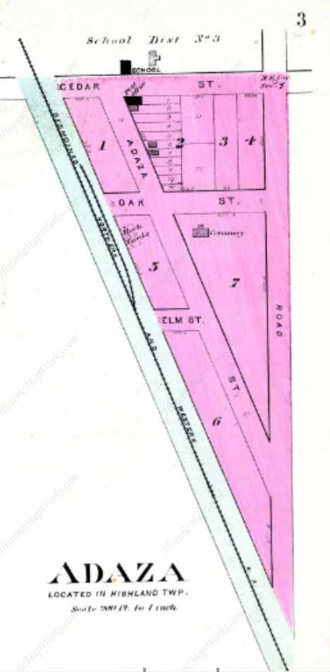
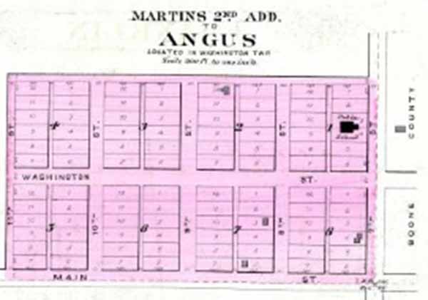
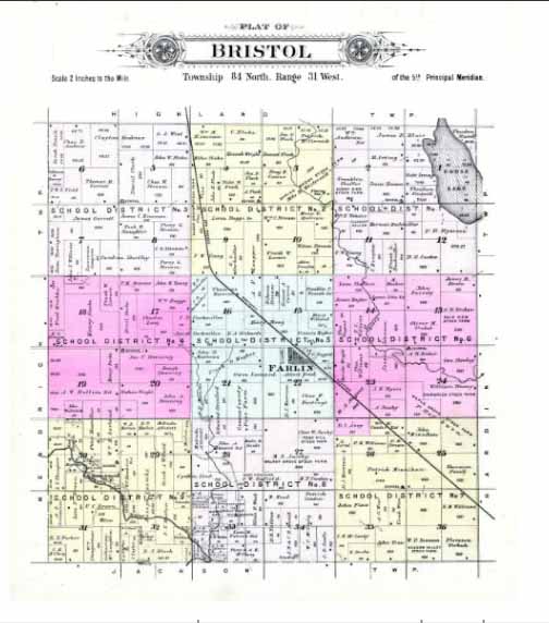
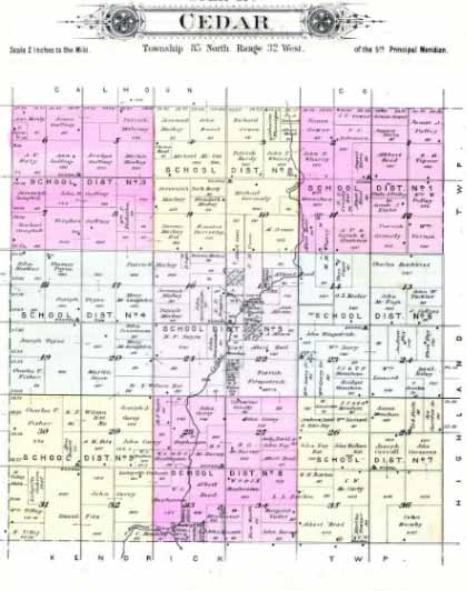
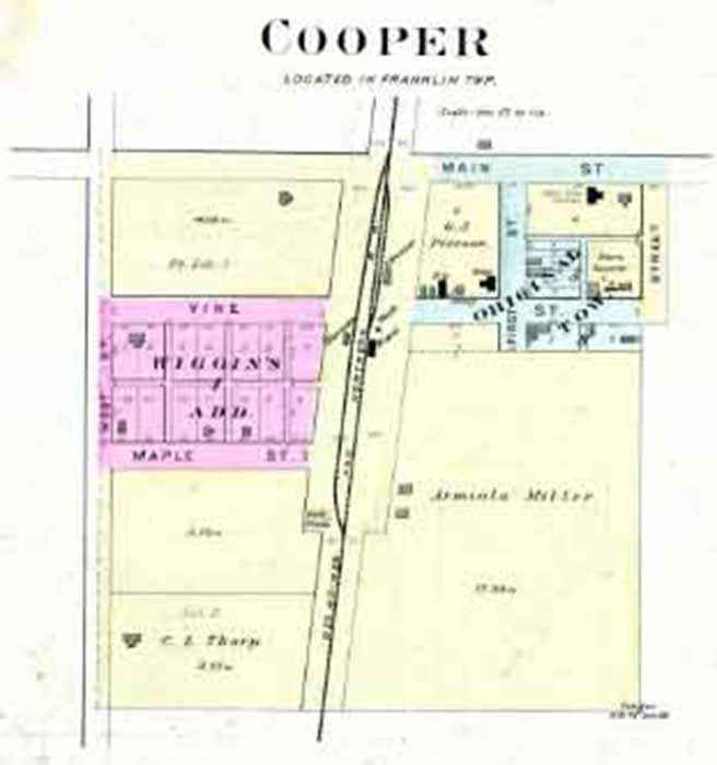
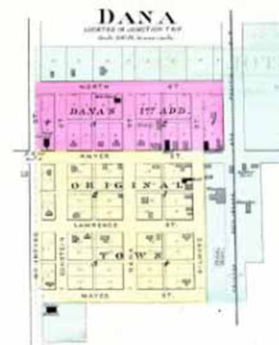
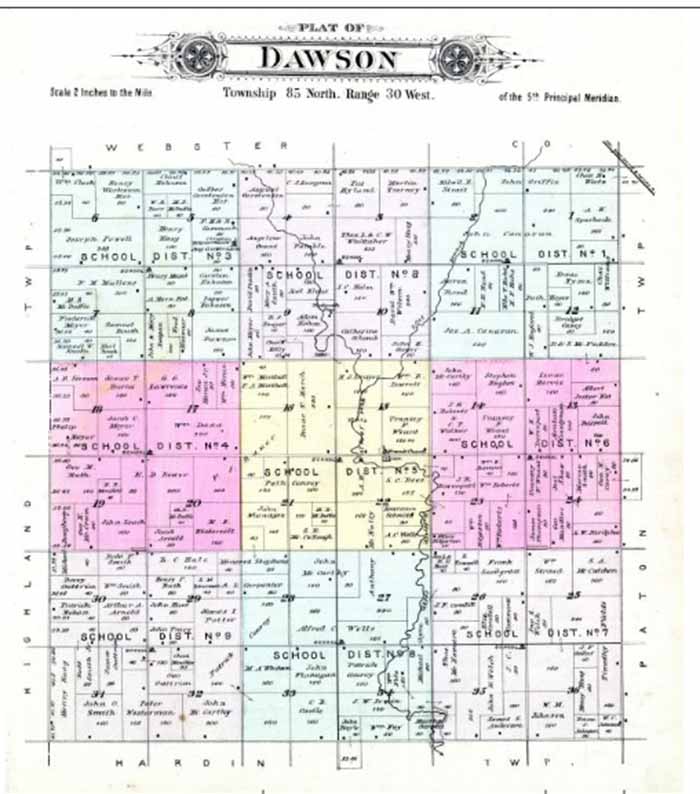
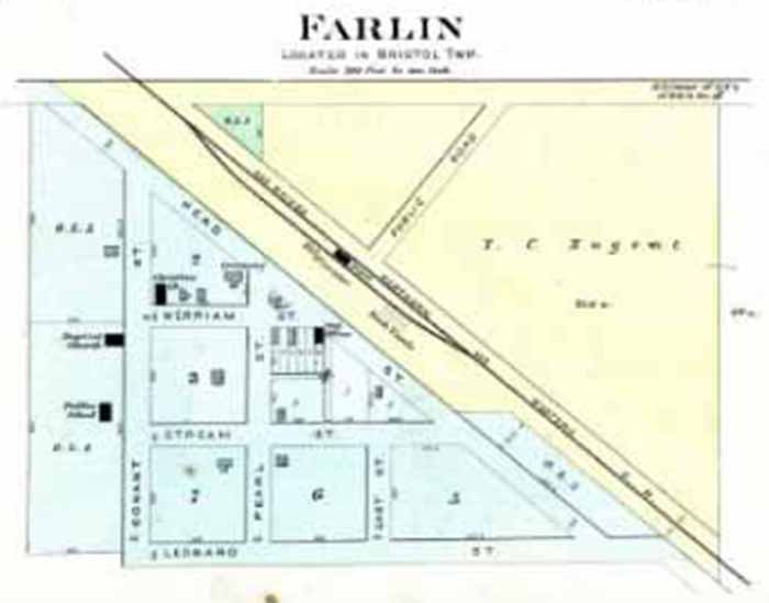
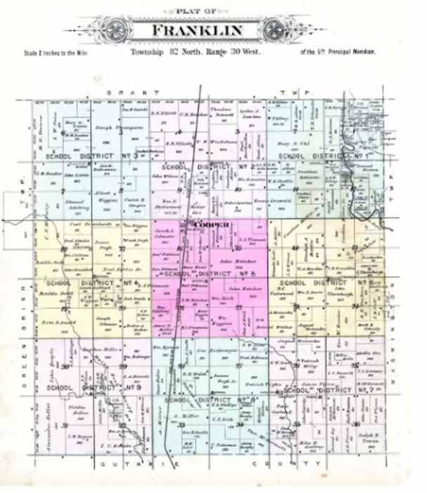
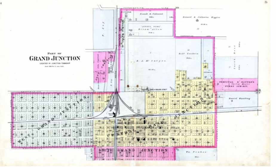
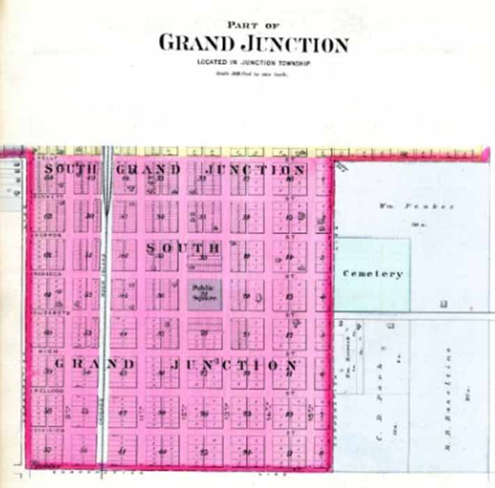
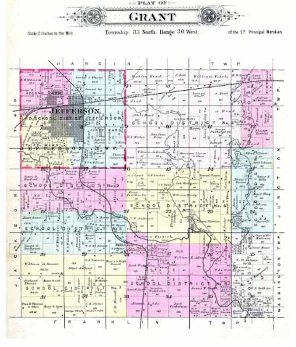
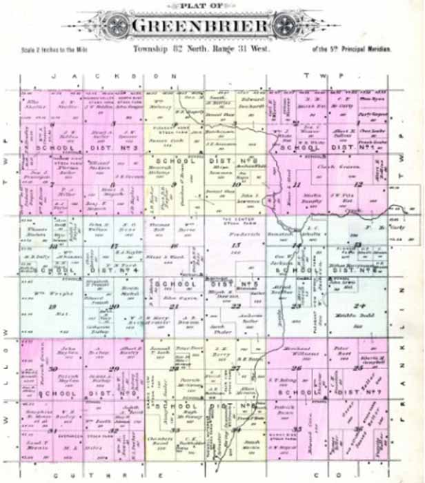
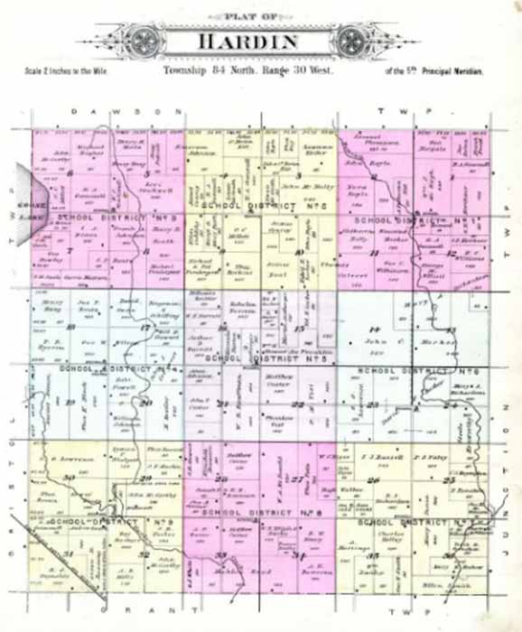
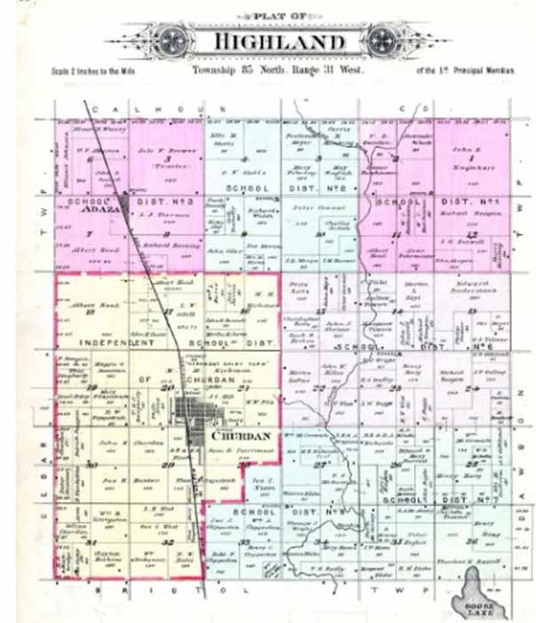
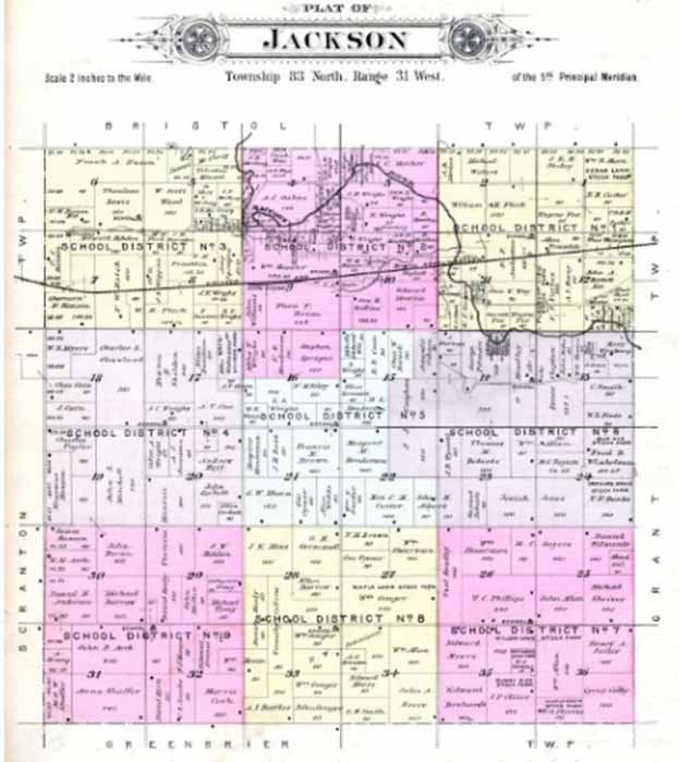
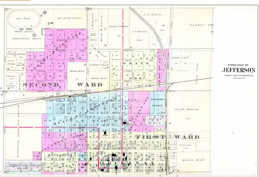
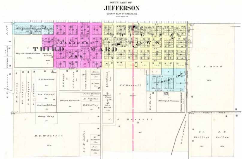
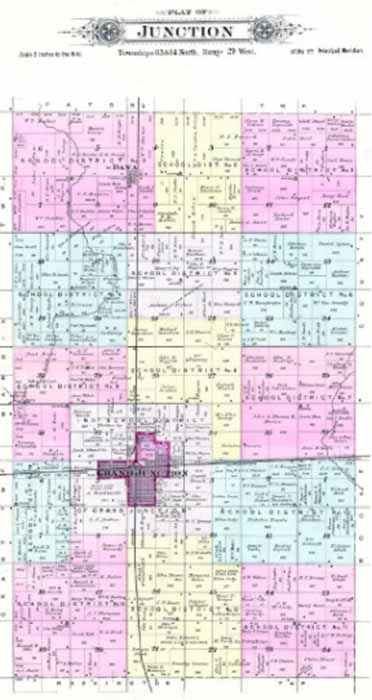
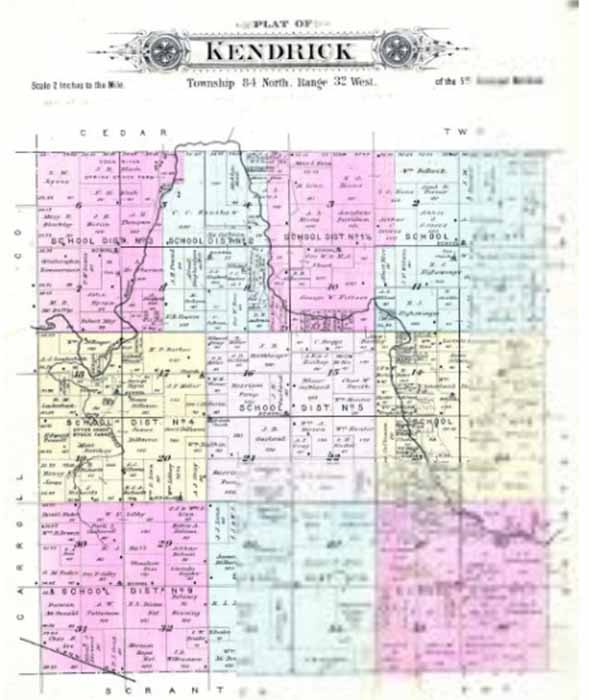
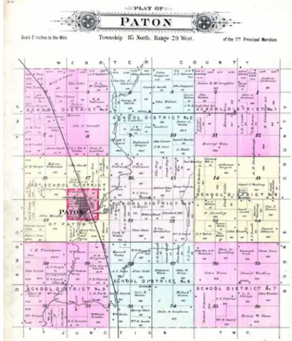
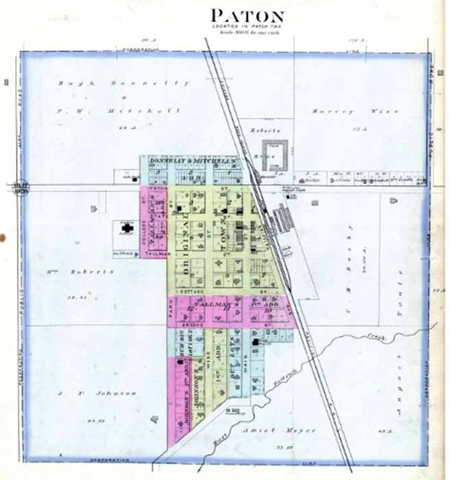
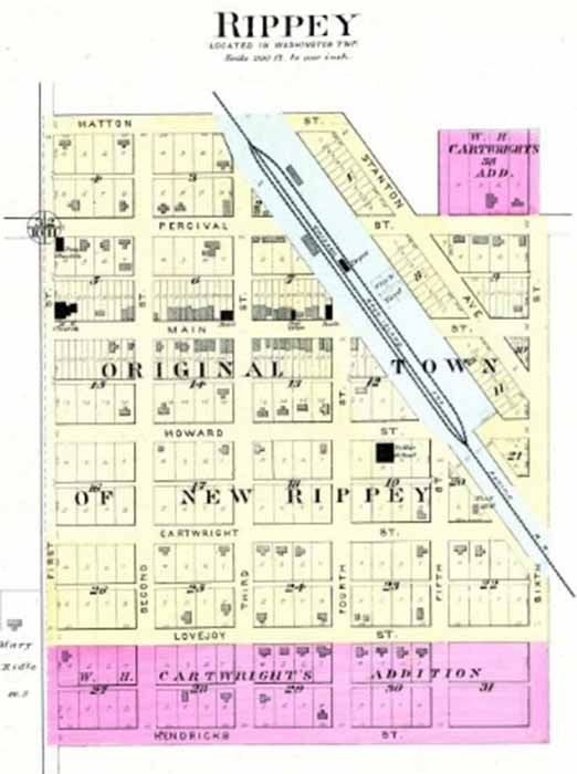
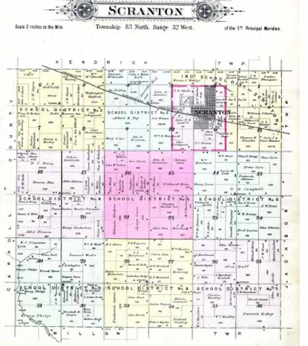
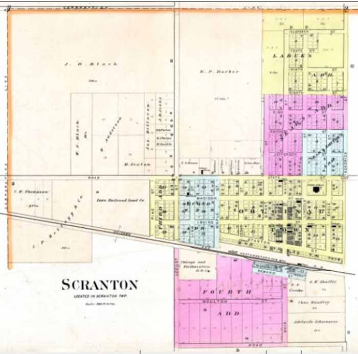
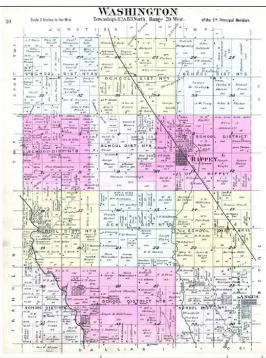
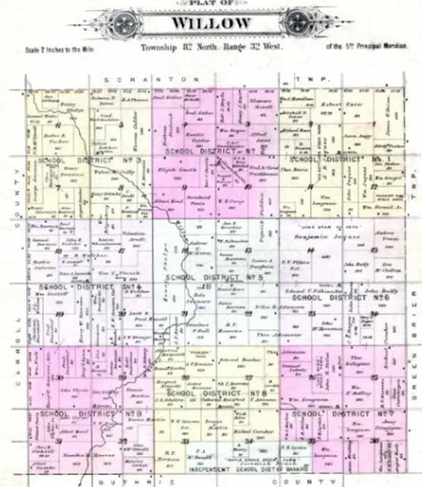
1896 Plat Maps and Names
Click image to enlarge
|
The 1896
plat book is a helpful tool, covering the years between the 1880
census
and the 1900 census. Lots of movement of families or persons moving where the grass was greener. Prices were cheap and lots of land was for sale. NAMES BY TOWNSHIP
MAPS
Names transcribed by Annette
DeCourcy Towler.
Source: www.ancestry.com Historic Land Ownership and Reference Atlases, 1507-2000 [database on-line]. Provo, UT, USA: The Generations Network, Inc., 2007. Original data: Maps provided by Historic Map Works, LLC. Historic Map Works, 865 Spring Street, Westbrook, ME 04092 |
Site Terms, Conditions & Disclaimer |