HISTORY
of
EMMET COUNTY
and
DICKINSON COUNTY
IOWA

A Record of Settlement, Organization,
Progress and Achievement
Volume 1
Chicago, Illinois
The Pioneer Publishing Company
1917


CHAPTER VII

TOWNSHIP HISTORY

The subordinate civic division known as the township doubtless had its origin in the old Teutonic "mark," though it was transplanted to this country from England. Says Fiske: "About 871 A. D. King Alfred instituted a small territorial subdivision nearest in character to and probably containing the germ of the American township."

The "small territorial subdivision" of King Alfred was called the "tunscipe." It was the political unit of popular expression, which took the form of mass convention or assembly called the "tun moot." The chief executive of the tunscipe was the "tun reeve," who, with the parish priest and four lay delegates, represented the tunscipe in the shire meeting.

In the settlement of New England, the colonies were at first governed by a general court, which also had legislative powers. The court was composed of the governor and a small council, generally made up of the most influential citizens. In March, 1635, the General Court of Massa‐ chusetts passed the following ordinance relating to local government in certain districts:

"Whereas, particular towns have many things that concern only themselves, and the ordering of their own affairs and disposing of business in their own town, therefore, the freemen of every town, or a majority of them, shall have power to dispose of their own lands and woods, and all appurtenances of said towns; to grant lots, and to make such orders as may concern the well ordering of their own towns, not repugnant to the laws and orders established by the General Court.

"Said freemen, or a majority of them, shall also have power to choose their own particular officers, such as constables, petty magistrates, sur-‐

EMMET AND DICKINSON COUNTIES 109

veyors for the highways, and may impose fines for violation of rules established by the freemen of the town ‐ provided that such fines shall in no single case exceed twenty shillings."

That was the beginning of the township system in the United States. Connecticut followed Massachusetts with a similar provision regarding local self-government, and from New England the system was carried to the new states of the Middle West. In the southern colonies the county was made the principal political united for the government of local affairs. Eight counties were organized in Virginia in 1634 and the system spread to other colonies, except in South Carolina the units corresponding to counties are called districts and in Louisiana they are known as parishes. The Illinos country was made a county of Virginia after G.en. George Rogers Clark's campaign of 1778.

The first provision for the establishment of civil townships northwest of the Ohio River was made by Governor St. Clair and the judges of the Northwest Territory in 1790. The term "civil township" is here used to distinguish it from the Congressional township of the official Government survey. The latter is always six miles square (except in certain cases of fractional townships), while the civil township varies in size and shape, and is marked by a local government. Even yet in New England the township is of more importance in the settlement of local questions of a political character, or the administration of local affairs, than is the county. The town meetings are still held regularly and through them most of the business of the local government is transacted. Every proposition to expend a considerable sum of money, for any public purpose whatever, is first submitted to the people at a town meeting. In the South the township is little more than a name, all the local business being transacted by the county authorities. Throughout the great Middle West there is a well-balanced combination of the two systems, the schools and roads being usually in charge of the township officials, while business that affects more than one civil township is controlled by the county. In nearly every state in the Mississippi Valley it is the custom to sumbit to the people at a general or special election the question of issuing bonds for township purposes, and this custom is a relic of the old town meeting system.

Township government was first established in Iowa while the state was a part of Michigan Territory. The Legislature of that territory in September, 1834, created the Township of Julien, which included the entire County of Dubuque ‐ that is, all that part of Iowa lying north of a line drawn due west from the foot of Rock Island. Emmet County was therefore a part of Julien Township, Dubuque County. South of the line was Des Moines County, which was erected into Flint Hill Township. When Iowa was made a part of Wisconsin by the act of April 20, 1836, the first Legislature of that territory set about amending the laws and

110 EMMET AND DICKINSON COUNTIES

the act of December 6, 1836, provided that "Each county within this territory now organized, or that may be hereafter organized, shall constitute one township for the purpose of carrying into effect the provisions of the amended laws."

The act of Congress organizing the Territory of Iowa, approved by President Van Buren on June 12, 1838, contained a provision that all township officers should be elected by the people. In his message of November 12, 1838, to the first Legislature that was ever convened in Iowa, Gov. Robert Lucas said: "The subject of providing by law for the organization of townships and the election of township officers, and defining their powers and duties, I consider to be of the first importance and almost indispensable in the local organization of the Government. Without proper township regulations it will be extremely difficult, if not impracticable to establish a regular school system. In most of the states, where a common school system has been established by law, the trustees of townships are important agents in executing the provisions of its laws."

On January 10, 1840, Governor Lucas approved the act providing for township organization. Under this act the question of forming a new township was to be submitted to the voters residing within the territory it was proposed to include in said township, and if a majority of the votes were in favor of the proposition the township should be organized. With some supplementary legislation, this system remained in force until after the admission of the state in 1846. Most of the counties created by the act of January 15, 1851, were declared to be a single township until the local authorities saw fit to make more.

When the office of county judge was abolished the township system assumed greater importance in Iowa than ever before. The act became effective on July 4, 1860, and required the voters of each township in a county to elect one supervisor at the next general election, the super‐ visors so elected to take office on January 1, 1861, and the board of supervisors was to perform all the duties formerly performed by the county judge. In 1862 the supervisors were given power to create new townships, and it was under this authority that the twelve civil townships of Emmet County were called into existence.

Each civil township in Emmet County corresponds to a congressional township and is therefore six miles square, except those forming the northern tier, where the congressional townships are fractional, so far as Emmet County is concerned, and contained only thirty square miles. The twelve townships are: Armstrong Grove, Center, Denmark, Ellsworth, Emmet, Estherville, High Lake, Iowa Lake, Jack Creek, Lincoln, Swan Lake and Twelve Mile Lake. Eight of these townships &das; Armstrong Grove, Center, Ellsworth, Emmet, Estherville, High Lake, Iowa Lake, Swan Lake and Twelve Mile Lake ‐ were organized prior to the

EMMET AND DICKINSON COUNTIES 111

burning of the courthouse in the fall of 1876, and the date of their erection and organization cannot be learned on account of the destruction of the supervisors' records.

ARMSTRONG GROVE TOWNSHIP

This township is the middle one of the eastern tier and includes Township 99, Range 31, of the Government survey. It is bounded on the north by the Township of Iowa Lake; on the east by Kossuth County; on the south by Denmark Township, and on the west by Swan Lake Township. The east fork of the Des Moines River flows diagonally across the township from northwest to southeast, and the southwest comer is watered by the Black Cat Creek. The surface is generally level or gently rolling, except along the streams, where it is more broken, and the soil is usually fertile. Some of the finest farms in the county are in this township.

In March, 1856, a man named Armstrong made his way up the Des Moines River from Fort Dodge looking for a location. In the grove on Section 36, Township 99, Range 31, he selected 160 acres for his claim. No white men were living near, and worn out by his journey he became lonesome, homesick and discouraged and as soon as the weather settled in the spring he returned to Mitchell County. The place were he selected his claim is still known as Armstrong's Grove and when the township was organized the name was conferred upon it. The first permanent settlement in that part of the county was made in 1864, when George Demmon settled in Section 36, near the place where the man Armstrong located eight years before, and Daniel W. Perry took a claim in Section 25 adjoining on the north. They were soon followed by James Thompson, Samuel Thobum (a Scotchman), John Carroll and the Parson, Dundas and Campbell families, most of whom settled along the Des Moines in the eastern part of the township. Edward Donovan, another early settler, located a claim on the Black Cat Creek, not far from the present village of Haifa. David Weir came in the fall of 1869 and bought George Demmon's farm in Section 36.

Settlement was slow for a time, but in the early '70s there were several families located in the township. In 1871 C. B. Mathews, W. Orcut and the Hurlbuts came from Racine, Wisconsin; William Jordan, from Jackson County, Iowa; Peter Conlan, Stephen Murphy, Patrick Harrity, Matthew McCormick and a few others from Minnesota. The next year the population was augmented by the arrival of David Canfield, who came from Illinois; Cornelius Canon and his father, James, settled on Section 12, a little northeast of the present town of Armstrong; Henry Brooks and S. B. and John Churchill came from Mitchell County, Iowa. James Canon and John Churchill were veterans of the War of 1812. The lat‐

112 EMMET AND DICKINSON COUNTIES

ter died about 1878. His daughter, Ann Eliza, afterward became the nineteenth wife of Brigham Young, the Mormon prophet.

About three-fourths of a mile east of the town of Armstrong was formerly a pond of about sixty acres which was called "Lake Weller," for Miss Eliza Weller, who homesteaded the quarter section upon which it was located.

The first marriage in the township was that of John Dundas and Jane Gibbons. The first death was that of Mrs. James Thompson. Her coffin was made by Daniel W. Perry. The first school was taught by Miss Hannah Hawks in the winter of 1866-67. She was succeeded by Mrs. Jennie Cummings, a "comely widow," who at the close of her term became the wife of Stephen Demmon, their wedding being the second in the township. In the summer of 1868 a school house was built by Daniel W. Perry and D. L. Bemis, of Estherville, at a cost of about seven hundred dollars, and Miss Emma Jillett taught the first term of school in the new building.

The Albert Lea & Estherville division of the Rock Island Railway system passed through the central portion of the township from east to west, and the Jewell & Sanborn division of the Chicago & Northwestern crosses the southwest comer. Armstrong on the former and Haifa on the latter are the railroad stations. The two railway lines afford good shipping facilities to all parts of the township.

In 1910 the population, including the incorporated town of Armstrong, was 1,038, and in 1915 the assessed valuation of the property, including that in the consolidated school district of Haifa, was $435,236.

CENTER TOWNSHIP

This township was erected by the board of supervisors prior to the burning of the court-house in the fall of 1876, and the destruction of the records renders it impossible to give the exact date of its establishment. It embraces Congressional Township 99, Range 33, and has an area of thirty-six square miles, nearly all of which is capable of being cultivated. Brown Creek, a tributary of the Des Moines River, flows in a south‐ westerly direction across the northwest comer, and the Des Moines River touches the southwest comer. The western part of Swan Lake extends into this township in the southeastern part, and about a mile west of it is Ryan Lake. The township was so named from its central location. It is bounded on the north by Ellsworth Township; on the east by Swan Lake ; on the south by High Lake, and on the west by the Township of Estherville.

On January 10, 1878, upon petition of the citizens living in the eastern tier of sections of Center Township, those sections ‐ 1, 12, 13, 24, 2& and

EMMET AND DICKINSON COUNTIES 113

36 ‐ were detached from Center and attached to Swan Lake by the board of supervisors. The next day the board reconsidered the order, which was then rescinded, and Center was restored to its original boundaries.

Among the early settlers of Center were James, Eli and R. E. Bunt, Jeremiah Clark, the Lingenfelter, Moulton, West and Cousins families, some of whom, or their descendants, still live in Emmet County. During the Civil war and the Indian troubles on the frontier there were very few settlers came to the county and most of those above named located their claims between 1864 and 1869.

In 1892 the Albert Lea & Estherville division of the Chicago, Rock Island & Pacific Railroad was built through the township, which stimulated its development. The western boundary is only one mile from the Estherville city limits and the village of Gruver is a station on the railroad, one and a half miles west of the eastern boundary, so that the people of the township have ample shipping facilities for the products of their farms.

The population in 1910 was 532, and in 1915 the property was valued for tax purposes at $431,865. During the school year of 1915-16 ten teachers were employed in the public schools.

DENMARK TOWNSHIP

Denmark Township occupies the southeast corner of the county and embraces Congressional Township 98, Range 31. The surface is generally rolling and is drained by the Black Cat Creek, which flows in a southeasterly direction across the township. Several ditches have been constructed, using the Black Cat Creek as an outlet, which makes Denmark one of the best drained townships in the county. On the north this township is bounded by Armstrong Grove; on the east by Kossuth County; on the south by Palo Alto County, and on the west by the Township of Jack Creek.

Prior to September 3, 1883, Denmark was a part of Armstrong Grove Township, but the minutes of the board of supervisors for that date contain the following entry: "The petition of H. Jensen and eleven others, resident electors of Township 98, Range 31, said territory being now a part of the civil township of Armstrong Grove, asking that said township No. 98 of Range No. 31 be set off as a civil township by itself to be known as Denmark Township, was taken up and on motion the prayer of said petition was granted."

At the same time the board ordered that the voting place at the general election of October 9, 1883, should be at the house of C. L. Lund, and S. D. Bunt, Paul P. Bogh and Peter Schultz were appointed judges of said election.

114 EMMET AND DICKINSON COUNTIES

The first settlers were James Thompson and S. B. Bunt, who entered land in 1872, though the township was then a part of Armstrong Grove and both are mentioned as early settlers of that township. A few months before the organization a number of families came from Denmark and located in the southeastern part of Emmet County. Among them were Hans Jensen, whose name headed the petition for the erection of the township, Morten, James and John N. Petersen, A. N. Gaarde, Lauritz Lauritsen„ Paul P. Bogh, Lars Hansen, Nels Nielsen and John Hendricksen. It was from these Danish families that the township derived its name.

In January, 1884, the first election for township officers was held at the house of C. L. Lund. Morten Peterson, William Nelsen and Lauritz Lauritsen were elected trustees; Neiss Bonnicksen, clerk; S. D. Bunt, justice of the peace; Paul P. Bogh, road supervisor.

When the first settlements were made in the township the town of Algona was the nearest trading point. In 1882 the Chicago & North‐ western Railroad was extended north from Algona and the village of Bancroft was started. It was not much of a town, but the general store there kept most of the goods needed by the early settlers and brought the opportunity to obtain supplies much nearer to the people of what is now Denmark Township. The first postoffice was established in 1885, with John Larsen as postmaster. It was located on his farm, about two miles east ot the present village of Ringsted. William Grey carried the mail from Seneca for about a year, after which Morten Petersen was the mail carrier for four years.

John H. Thompson, a son of James Thompson, was the first white child born in the township. The first school house was built in 1884. There are now seven school buildings, and during the school year of 1915-16 ten teachers were employed. In 1910 the population was 907 and in 1915 the assessed value of the property was $448,598, which was the second highest valuation in the county.

ELLSWORTH TOWNSHIP

This is one of the fractional townships of the northern tier. It includes all that part of Congressional Township 100, Range 33, lying in Emmet County; is five miles in extent from north to south and six miles from east to west, having an area of thirty square miles. Birge Lake lies on the eastern border and is drained by Soldier Creek, a tributary of the east fork of the Des Moines River. Grass Lake, in the north‐ western portion, is drained by Brown Creek, and another small stream flows in a southeasterly direction through the central part, so that the township is well watered. Ellsworth is bounded on the north by the State

EMMET AND DICKINSON COUNTIES 115

of Minnesota; on the east by Lincoln Township; on the south by Center, and on the west by the Township of Emmet.

Not much was done toward the settlement of this township until after the close of the Civil war. One of the pioneers was Capt. Lyman S. Williams, who located in what is now Ellsworth in 1867, and whose widow now lives at Cedar Rapids, Iowa. A sketch of Captain Williams is given in Chapter VI. About a year after Captain Williams came the Mattson family, several members of which became prominent in the affairs of Emmet County. Lois Mattson became the wife of Charles W. Dillman and removed to Blue Earth, Minnesota. S. A. Prosser was also an early settler in this township.

Ellsworth Township is one of those erected prior to the destruction of the court-house by fire, and the records pertaining to its creation and organization are lost. In its industrial and educational development it has kept pace with the other townships of the county. There are seven public schools buildings, and during the school year of 1915-16 twelve teachers were employed. The population in 1910 was 481, and the assessed valuation of property in 1915 was $323,195. Huntington, a station of the Minneapolis & St. Louis Railroad, near the northwest corner, is the only village and postoffice in the township.

EMMET TOWNSHIP

In the northwest corner of the county lies the Township of Emmet. It embraces that part of Congressional Township 100, Range 34, lying in Iowa and has an area of thirty square miles. On the north it is bounded by the State of Minnesota; on the east by Ellsworth Township; on the south by Estherville Township, and on the west by Dickinson County. The west fork of the Des Moines River enters the township from Minnesota about three-fourths of a mile east of the northwest corner and flows in a southeasterly direction into Estherville Township. Along the river there are some bluffs, but the greater part of the township is fertile, tillable land.

Emmet Township derives its name from the county. It was created prior to 1876 and the records of its erection and organization were lost in the court-house fire of that year.

To Emmet Township belongs the distinction of being the site of the first settlement made in the county. As narrated in one of the preceding chapters, Jesse Coverdale, George C. Granger, William Granger, Henry and Adolphus Jenkins and D. W. Hoyt located claims in this township in the summer of 1856. The neighborhood where they settled was near the Des Moines River, in a tract of timber afterward known as "Emmet Grove" sometimes called "Granger's Grove." Here the first postoffice

116 EMMET AND DICKINSON COUNTIES

was established under the name of Emmet, with George C. Granger as the first postmaster. Mr. Granger was also the first merchant in the county. Jesse Coverdale served as second lieutenant of Company A, Northern Border Brigade, at the time of the Civil war, and was afterward elected one of the county board of supervisors, in which capacity he served for one term of three years.

The Minneapolis & St. Louis Railroad runs through the southeastern portion, but there is no station within the township limits. Estherville, which is only one mile from the southern boundary, and Huntington, in the northwest comer of Ellsworth Township, are the most convenient trading and shipping points.

There are five public schools in the township and during the school year of 1915-16 six teachers were employed. The population in 1910 was 375 and in 1915 the property was assessed for taxation at $284,120.

ESTHERVILLE TOWNSHIP.

This is the middle township of the western tier and includes Congres‐ sional Township 99, Range 34. Its area is therefore thirty-six square miles and it is bounded as follows: On the north by Emmet Township; on the east by Center; on the south by Twelve Mile Lake, and on the west by Dickinson County. The west fork of the Des Moines River crosses the northern boundary near the northwest corner of Section 2 and from that point it flows almost south for a distance of two miles, when it turns more to the southeast and crosses the eastern boundary about two miles north of the southeast corner. Along the west side of the river are the largest hills in the county. East of the Des Moines the surface is a rolling plain, which is also the character of the surface in the western portion, near the Dickinson County line. On the western border, in Section 18, is a small body of water called Four Mile Lake. Its outlet falls into the Des Moines at Estherville.

Estherville was one of the first civil townships to be established in Emmet County, and takes its name from the county seat, which is situated within its limits. As in the case of all the early townships, the records relating to the erection and organization of Estherville were destroyed by the burning of the court-house in October, 1876, and the exact date of its establishment cannot be ascertained.

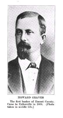
Among the first settlers in this township were Robert E. Ridley and his wife, A. H. Ridley, and the Graves family, the former coming from the State of Maine in the spring of 1857, and the Graves family from Winneshiek County, Iowa, a little later. Robert E. Ridley, the pioneer settler of the township, is still living in Estherville. Most of the history of this township centers about the county seat and is told in connection with the City of Estherville in another chapter.

EMMET AND DICKINSON COUNTIES 117

No other township in the county is as well provided with transportation facilities. The Chicago & Sioux Falls division of the great Rock Island Railway system and the Minneapolis & St. Louis Railroad both pass through Estherville, and a branch of the former runs from Estherville to Albert Lea, Minnesota, where it connects with a main line running between. Minneapolis and Des Moines.

In 1910 the population, exclusive of the City of Estherville, was 454. Outside of the city there are four public schools that in the school year of 1915-16 employed four teachers. In 1915 the assessed valuation of the property, not including that within the city, was $449,306, or nearly one thousand dollars for each man, woman and child living in the rural districts.

HIGH LAKE TOWNSHIP

High Lake Township, which takes its name from a lake situated within its borders, is one of the southern tier. It includes Congressional Township 98, Range 33, and has an area of thirty-six square miles, about two of which are water ‐ High and Mud lakes. The west fork of the Des Moines River flows southwardly through the western part and is the only stream in the township. The boundaries of the township are formed as follow: Center Township on the north; Jack Creek Township on the east; Palo Alto County on the south, and the Township of Twelve Mile Lake on the west.

The first settler in what is now High Lake Township was John Rourke, a native of the Emerald Isle, who located a claim at Island Grove in August, 1856. His wife was the first white woman to become an inhabitant of Emmet County, and their son Peter, who was born on January 4, 1857, was the first white child born in the county. Other early settlers here were James Maher and the Conlans, mentioned in a former chapter. Still another early settler was Alfred Nicholson, a well‐ educated Irishman, who was a somewhat noted character in the early history of the county on account of his eccentricities, one of which was his fondness for whisky. He was a great reader and was well informed on a multitude of subjects, about which he could converse intelligently, even when under the influence of liquor.

The civil Township of High Lake was established before the court‐ house fire, so frequently referred to in connection with the history of the several townships of the county, and the date of its erection and organization is therefore lost.

Fairly good transportation facilities are provided by the Chicago, Rock Island & Pacific Railroad, which runs along the western border, west of the Des Moines River. Wallingford, in the west side of Section 7, is a station on this road and the only village in the township. People

118 EMMET AND DICKINSON COUNTIES

living east of the Des Moines, in the southern part of the township, find more convenient railroad accommodations at Graettinger, the next station south of Wallingford, just across the line in Palo Alto County.

According to the last report of the county superintendent of schools, there are nine school buildings in High Lake, in which ten teachers were employed during the school year of 1915-16. The population in 1910 was 615, and the valuation of property in 1915, as shown by the county auditor's abstract, was $415,480.

lOWA LAKE TOWNSHIP

This township is situated in the northeast corner of the county and embraces Congressional Township 100, Range 31, or that portion of it lying south of the state line. It is bounded on the north by the State of Minnesota; on the east by Kossuth County; on the south by Armstrong Grove Township, and on the west by the Township of Lincoln. From north to south it is five miles in extent, and from east to west six miles, giving it an area of thirty square miles. The surface is an elevated plain, the only watercourse being the east fork of the Des Moines River, which just touches the southwest corner. Considerable ditching has been done in this township.

When first created, which was some time before the courthouse fire, this township was named Fairview and included also the present township of Lincoln. Subsequently the name was changed to Iowa Lake, after the beautiful body of water that lies in the extreme northeast comer of the county, extending into Minnesota.

In the fall of 1857 J. R. Hopkins and a man named Gill took up claims in sections 11 and 12, Township 100, Range 31, near the south end of Iowa Lake. These two men were the first settlers in that part of the county. Iowa Lake is one of the two townships of Emmet County that is not touched by a railroad. Dolliver on the west and Armstrong on the south are the most convenient railroad stations and shipping points.

In 1910 the population of the township was 337, and in 1915 the assessed valuation of the property was $268,502. During the school year of 1915-16 there were five public schools in operation and a new school‐ house was built in the summer of 1916.

JACK CREEK TOWNSHIP

The Township of Jack Creek is located in the southern tier and embraces Congressional Township 98, Range 32, having an area of thirty‐ six square miles, the greater portion of which is prairie with an exceedingly fertile soil. It is bounded on the north by Swan Lake Township ; on the east by Denmark; on the south by Palo Alto County, and on the

EMMET AND DICKINSON COUNTIES 119

west by High Lake Township. It takes its name from a small stream flowing in a southerly direction through the central part, but which has been converted into a drainage ditch known in the county records as No. 17.

The first settlers in this part of the county were Scandinavians, among whom were B. R. Knudson, Ole Aanonson and Nels Iverson, who were instrumental in having the township organized. The minutes of the board of supervisors for June 8, 1883, contain the following entry: "The petition of B. R. Knudson and others to have Township 98, Range 32, set off as a civil township to be known as Jack Creek was taken up and on motion was granted. Ayes, Christopher, Jenkins and Richmond; nays, Allen and Jarvis."

On September 3, 1883, the board ordered the election of October 9, 1883, to be held at the B. R. Knudson schoolhouse, and appointed B. R. Knudson, Ole Aanonson and Nels Iverson judges of the election. No returns of the first election for township officers are obtainable. Jack Creek has no railroad. Maple Hill on the north, Ringsted on the east, Wallingford on the west and Graettinger in Palo Alto County are the most convenient railroad stations.

The first school house was that known as the Knudson school house, where the first election in the township was held. During the school year of 1915-16 there were seven public schools in operation, employing nine teachers. The school in the northeast corner of the township has been abolished by the formation of the consolidated school district of Haifa, but in the summer of 1916 a new school building was erected at Hoprig, a little hamlet in the southern part of the township.

In 1910 the population of Jack Creek was 396, and in 1915 the assessed valuation of the property was $358,593.

LINCOLN TOWNSHIP.

Lincoln Township, situated in the northern tier, embraces fractional Township 100, Range 33. It is bounded on the north by the State of Minnesota; on the east by Iowa Lake Township; on the south by Swan Lake, and on the west by the Township of Ellsworth. The township is well watered; the east fork of the Des Moines River, which rises in Lake Okamanpadu near the northeast corner, flowing southward through the eastern portion, and Soldier Creek, the outlet of Birge Lake, flowing in a southeasterly direction through the central part. The latter stream has two or three small tributaries which contribute to the natural drainage of the township.

In the fall of 1864 W. H. Brown settled near the shore of Lake Okamanpadu (or Tuttle Lake) and was the first man to enter land in

120 EMMET AND DICKINSON COUNTIES

what is now Lincoln Township. Other early settlers were J. P. and Patrick Bagan, Fred Moltzen, Frederick Schultz and the Persons family, most of whom located their claims along the east branch of the Des Moines River or in the grove about Lake Okamanpadu. For several years this township formed a part of Iowa Lake Township. On January 10, 1878, W. H. Brown presented a petition to the board of supervisors asking that the township be detached from Iowa Lake and annexed to Swan Lake, but the board refused to grant the petition and the township remained a part of Iowa Lake for nine years longer before any further action was taken. On June 6, 1887, the following petition was presented to the board of supervisors:

"The undersigned, your petitioners, respectfully state that they are residents and legal voters of Township 100, Range 32, in Emmet County, Iowa; that said township is now a part of the civil township of Iowa Lake; that there are now within the limits of said Congressional township ten or more legal voters; whereas your petitioners pray your honorable body that a new civil township be formed and created out of the territory embraced in said Congressional township, to be known and designated as the Township of Bagan, and that your honorable body make the necessary and proper orders for the creation of said township."

This petition was signed by Patrick Bagan, C. F. Persons, W. W. Persons, W. Rosenburg, Fred Allatzon, L. F. Persons, Fred Schultz, E. W. Persons, J. P. Bagan and H. C. Wilson. The board, after considering the petition, issued the order for the erection of the new township, but changed the name to Lincoln, in honor of Abraham Lincoln, the sixteenth President of the United States.

On September 6, 1887, the board designated the house of John Bagan as the place of holding the first election in the new township, and appointed John Bagan, Patrick Bagan and Fred Moltzen judges and Fred Schultz clerk to conduct said election, which was the general election of October 11, 1887. At that election the following township officers were chosen: M. M. Vallian, Fred Moltzen and P. Schultz, trustees; John Bagan, clerk; J. P. Bagan, assessor; C. F. Persons, justice of the peace; Patrick Bagan, road supervisor.

In 1899 the Jewell & Sanborn division of the Chicago & Northwestern Railway system was built through Emmet County and passes through Lincoln Township. Near the center of the township was established the station of Dolliver, giving the people of Lincoln a shipping point for the products of their farms.

The several public schools of the township have been consolidated into one district and a fine public school building erected at Dolliver. Seven teachers were employed during the school year of 1915-16. In

EMMET AND DICKINSON COUNTIES 121

1910 the population, including the village of Dolliver, was 396, and in 1915 the assessed valuation of the property was $336,764.

SWAN LAKE TOWNSHIP.

Swan Lake is one of the two central townships and includes Congressional Township 99, Range 32. It was erected as a civil township some time previous to the burning of the county records, and was named after the body of water in the southwestern part and extending into Center Township. The surface is undulating prairie. Soldier Creek and the east fork of the Des Moines River touch the northeast corner and the Black Cat Creek touches the southeast corner. Several ditches have been constructed in different parts of the township and Swan Lake is now one of the most productive agricultural districts of the county. It is bounded on the north by Lincoln Township; on the east by Armstrong Grove; on the south by Jack Creek, and on the west by the Town of Center. Its area is thirty-six square miles.

Among the pioneers of this township were T. O. Burd, Joseph Lee, whose son, N. J. Lee, is now one of the judges of the District Court in the Fourteenth Judicial District, and the Lerdall family. During the Indian troubles in Minnesota in 1862-63, a number of families fled from that state and sought refuge in Emmet County. Some of them located in what is now Swan Lake Township and became permanent settlers.

Through the central part of the township, running east and west, is the Estherville & Albert Lea division of the Chicago, Rock Island & Pacific Railway system, and the Jewell & Sanborn division of the Chicago & Northwestern crosses the northeast corner. Maple Hill on the former and Gridley on the latter are the railroad stations in the township. About a mile and a half west of the western boundary is the station of Gruver, on the Rock Island line. The two railroads provide better transportation and shipping facilities than is usually found in rural communities.

Only two townships in the county ‐ Emmet and Iowa Lake ‐ reported a smaller population than Swan Lake in 1910, when it was 382. While it then stood tenth in population, in 1915 it was sixth in valuation of property. Including the consolidated school district of Swan Lake, the property of the township was appraised at $400,652.

TWELVE MILE LAKE TOWNSHIP

This township occupies the southwest comer of the county. On the north it is bounded by Estherville Township; on the east by High Lake Township; on the south by Palo Alto County, and on the west by the County of Dickinson. It embraces Congressional Township 98, Range 34, and has an area of thirty-six square miles. The only watercourse

122 EMMET AND DICKINSON COUNTIES

in the township, as shown on the map, are the outlet of Twelve Mile Lake, which flows westwardly into Dickinson County, and a small tributary of the Des Moines River in the southeastern part.

In 1860 a number of Norwegians came to Emmet County and settled along the Des Moines Valley south of Estherville. Among them were the Thorsons, Paulsons and Petersons, some of whom located in what is now Twelve Mile Lake Township, where they or their descendants are still living. According to the best authority obtainable, when the first civil townships were created in Emmet County, the present township of High Lake and Twelve Mile Lake were included in "Peterson Township," so named from one of the prominent Norwegian pioneers. When Peterson Township was divided, the western portion of it was named Twelve Mile Lake, for the lake in sections 20 and 21, which was then supposed, to be twelve miles from Estherville, though in reality the distance is only about eight miles.

The Minneapolis & St. Louis Railroad was built through this township in 1898-99 and the town of Raleigh near the northern boundary was laid out. It is the only village and postoffice in the township, but the town of Wallingford, just across the border in High Lake Township, is a convenient trading and shipping point for those living in the eastern portion.

According to the latest report of the county superintendent of schools, there are nine schoolhouses in the township and during the school year of 1915-16 there were nine teachers employed. In 1910 the population was 449, and in 1915 the property was valued for taxation at $337,034.


 1917 HISTORY INDEX PAGE

 HISTORY INDEX PAGE

DICKINSON COUNTY MAIN PAGE