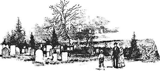
This page was last updated on Friday, 25 July 2008

IAGenWeb logo

 Delaware County, Iowa  


 Cemetery Directory


Have you walked a Delaware County cemetery?
Please consider sharing your information with other researchers.

~ Click here to share your information ~
 

   The cemeteries listed here have been compiled from various sources (obituaries, death records, family records, gravestone photos, W.P.A. Cemetery Survey (Works Project Administration, Graves Registration Survey) and researcher personal records).  The W.P.A. is rampant with errors and incomplete.  If you find errors or missing information, please email me the corrections and I will be happy to update and or correct the errors.


Submit gravestone photos here               

Click on the logo to submit your photos        >>>>>

6546 photos submitted to date                 

~ 29 May 2008 ~                    

IAGenWeb Gravestone Photo Project logo


WPA, Iowa Graves Survey

     The transcription of the Delaware County, Iowa WPA is completed and contains a total of 7,509 records. A BIG THANK YOU goes to Gloria Irwin and Sandra Carter the volunteer transcribers of this huge job!

      The WPA records should only be used as a GUIDE and not as factual proof of death or burial. There are MANY errors in these records. 


Cemeteries in Delaware County

Abbreviations you will find in the following online cemetery indexes:

b.  :Born

d.  :Died

m. :Married

n/d: No date

b/o: Brother of

d/o: Daughter of

h/o: Husband of

s/o: Son of

w/o: Wife of


CEMETERY

GEOGRAPHICAL LOCATION
Latitude / Longitude

Adams a.k.a. Pleasant Hill

Sec. , Ryan, Adams Twp.; 42.296ºN/91.499ºW

View Map

Allison

Sec. 27, Earlville, Delhi Twp.; 42.40420/-91.29180

Argard

Sec. , Lower Bay, Union Twp.

Bailey's Ford a.k.a. Dunton

Sec. 15, Manchester, Delaware Twp.; 42.434ºN/91.410ºW

View Map

Bremen

Sec. ,Delhi, Delhi Twp.; 42.426ºN/91.338ºW

View Map

Brown (Clayton County)

Sec. 33 SW/NE, Mallory Twp.; 42.653ºN / 91.201ºW
View Map

Buck Creek

    Photographs

Sec. 20, Hopkinton West, Union Twp.;  42.33610, -91.34270

Calvary

Sec. 19, Ryan, Hazel Green Twp.; 42.326ºN/91.479ºW

View Map

Coffins Grove

Sec. 23, Coffins Grove Twp.; 42.499ºN/91.529ºW

View Map

Dunton a.k.a. Bailey's Ford Cemetery

Sec. 15,Manchester, Delaware Twp.; 42.434ºN/91.410ºW

View Map

Edgewood


A

B

C

D

E

F

G

H

I

J

K

L

M


N

O

P

Q

R

S

T

U

V

W

X

Y

Z

Sec. 1, Edgewood, Honey Creek Twp.; 42.637ºN/91.387ºW

View Map

Evergreen

Sec. 20, Earlville, Oneida Twp.; 42.426ºN/91.338ºW

View Map

Fairview

Sec. 22, Earlville, Oneida Twp.; 42.479ºN/91.261ºW

View Map

Forestville

Sec. 36, Dundee, Richland Twp.; 42.600ºN/91.529ºW

View Map

Golden Prairie

Sec. 9, Ryan, Hazel Green Twp.; 42.36110/-91.42270

Grantview

Sec. 29, Greeley, Elk Twp.; 42.583ºN/91.333ºW

View Map

Greenwood

Sec. 29, Masonville, Coffins Grove Twp.; 42.486ºN/91.576ºW

View Map

Grove Creek

Sec. 33, Hopkinton West, Union Twp.; 42.301ºN/91.315ºW

View Map

Hamblin a.k.a. Portable

Sec. 28, Manchester, Delaware Twp.; 42.401ºN/91.427ºW

View Map

Hopkinton

Sec. 18, Hopkinton East, South Fork Twp.; 42.34220/-91.23820

Hutson

Sec., Thorpe, Honey Creek Twp.; 42.56670/-91.40010

Map information

Lillibridge a.k.a Sands Farm

Sec. 11, Manchester, Milo Twp.; 42.44300/-91.39180

Livingston (private family cemetery)

Sec. 19, Hopkinton East, South Fork Twp.; 42.328ºN/91.244ºW

View Map

McMahon  a.k.a. St. Patrick's

Sec. 9, Colesburg, Colony Twp.; 42.624ºN/91.193ºW

View Map

Manchester

Sec. , Delaware Twp.;

Mead

Sec. 16, Thorpe, Delaware Twp.; 42.524ºN/91.441ºW

Milo Township 

Sec. 36, Manchester, Milo Twp.; 42.39220/-91.37820

Mount Hope

Sec., Bremen Twp.;

Mount Pleasant

Sec. 12, Hopkinton (East), South Fork Twp.; 42.36110/-91.14600

Nicholson Burial Ground

  1 listed burial

Sec., South Fork Twp.;

Noble

Sec., Thorpe, Honey Creek Twp.

Oak Hill

sec. 4, Colesburg, Colony Township; 42.639ºN/91.193ºW

 View Map

Oakland 


A

B

C

D

E

F

G

H

I

J

K

L

M


N

O

P

Q

R

S

T

U

V

W

X

Y

Z

Sec. 29, Manchester, Delaware Twp.; 42.498ºN/91.456ºW

View Map

Peace Lutheran

Sec. 8, Ryan, Adams Twp.; 42.361ºN/91.461ºW

View Map

Pine View

  A-K   L-Z

Sec. 29., Earlville, Oneida Twp.; 42.488ºN/91.341ºW

View Map

Platt

Sec. 23, Petersburg, Bremen Twp.; 42.598ºN/91.158ºW

View Map

Pleasant Hill

Sec. 36, Thorpe, Delaware Twp.; 42.600ºN/91.499ºW

Pleasant Hill a.k.a. Adams

Sec. , Ryan, Adams Twp.; 42.296ºN/91.499ºW

View Map

Pleasant Valley

Sec. 24, Thorpe, Richland Twp.;

Plum Creek

Sec. 13, Earlville, Oneida Twp.; 42.434ºN/91.262ºW

View Map

Portable a.k.a. Hamblin

Sec. 28, Manchester, Delaware Twp.; 42.401ºN/91.427ºW

View Map

Reynolds

Sec. 34, Dundee, Richland Twp.; 42.56250/-91.54180

Rock Prairie

Sec. 23, Thorpe, Delaware Twp.; 42.506ºN/91.402ºW

View Map

Rockville

Sec. 24, Dyersville (West), Bremen Twp.; 42.41810/-91.14460

Roe

Sec. 35, Thorpe, Honey Creek Twp.; 42.56670/-91.40010

Map information

Saint Albert

Sec. 17, Dundee, Richland Twp.; 42.605ºN/91.588ºW

View Map

Saint Francis Xavier

Sec. 25, Dyersville, Bremen Twp.; 42.488ºN/91.135ºW

View Map

Saint John's

Sec. 17, Earlville, Oneida Twp.; 42.431ºN/91.335ºW

View Map

Saint Joseph's

Sec. , Earlville, Oneida Twp.; 42.480ºN/91.262ºW

View Map

Saint Joseph's

Sec. 29, Greeley, Elk Twp.; 42.58280/-91.33400

Saint Mark's

Sec. 2, Edgewood, Honey Creek Twp.; 42.63750/-91.38880

Saint Marcus

Sec. ,  Honey Creek Twp.;

Saint Mary's (Manchester)

Sec. 29, Manchester, Delaware Twp.; 42.485ºN/91.577ºW

View Map

Saint Mary's (Masonville)

Sec.29, Masonville, Prairie Twp.; 42.497ºN/91.459ºW

View Map

Saint Patrick (McMahon)

Sec. 9, Colesburg, Colony Twp.; 42.624ºN/91.193ºW

View Map

Saint Peter and Saint Paul

Sec. 4, Petersburg, Bremen Twp.; 42.5547ºN/91.2085ºW

View Map

Sand Creek

Sec. 11, Masonville, Prairie Twp.; 42.443ºN/91.519ºW

View Map

Sands Farm a.k a. Lillibridge

Sec. 11, Manchester, Milo Twp.; 42.44300/-91.39180

Sand Spring

Sec. , Sand Springs, South Fork Twp.; 42.319ºN/91.171ºW

View Map

Silver Creek

     (A - M)  (N -Z)

Sec. 5, Coggon, Adams Twp.; 42.36940/91.57880

Map information

Spring Branch

Sec. 2 & 3, Manchester, Delaware Twp.; 42.469ºN/91.403ºW

View Map

Spring Hill

Sec. 28, Dundee, Richland Twp.; 42.574ºN/91.553ºW

View Map

Stranger Farm

Sec. 8, Dundee, Richland Twp.; 42.56940/-91.59320

Map information

Strawberry Point (Strawberry Point, Clayton Co.)

Strawberry Point, Cass Twp.; 42.681ºN / 91.523ºW
View Map

Thorpe Union

Sec. 31, Thorpe, Honey Creek Twp.; 42.56390/-91.47010

View Map

Upper Bay Church

Sec. 36, Coggon, Milo Twp.42.38890/-91.37570

Map information

Willard

Sec. 8, Hopkinton East, South Fork; 42.35830/-91.21960

Zion

      (A -I)     (J - Z)

Sec. 6, Colesburg, Colony Twp.; 42.638ºN/91.249ºW

View Map


State Assn. for the Preservation of Iowa Cemeteries

The organization is dedicated to the preservation of all cemeteries in Iowa. You will also find excellent information on repairing and restoring Headstones or Monuments. Wont you join us in preserving and saving the cemeteries of our ancestors in Iowa and all states. 

Off Site Cemetery Links

Return to Delaware County