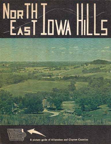
![]()
by Apple Jack During the time I’ve lived in the
extreme Northeast corner of the State of Iowa, people at
one time or another have said, "What this country
needs is a good guide of the area." This book is an
attempt to satisfy that need. I enjoy photography and the
result is a picture book. I make no claims for the
accuracy of the information for it is listed as I saw it,
and as I received information from the residents of the
various communities. The book represents about three
thousand miles of picture taking and information
gathering during two summers. All in all, it is intended
to be an "introduction" to Northeast Iowa, an
invitation for you to spend more time here finding new
views, camping areas, fishing spots, boating areas and
scenic drives. |
 |
What’s the country like? Well…most of it is scenic, first of all, because it contains many rivers and streams flowing through it on their way to the Mississippi River. These streams start from uplands, mostly above one thousand feet above sea level and end in the Mississippi only six hundred feet above sea level. This means that many streams have rugged valleys and rushing currents, which leads, in turn, to good trout fishing. The three most important rivers, other than the Mississippi, are the Upper Iowa and Yellow River in Allamakee county and the Turkey River-Volga combination in Clayton county. All three have carved beautiful valleys with limestone bluffs which missed being flattened by the many sheets of glacial ice of years ago.It is one of the coldest sections in the state during the winter but remains just a little cooler in the summer months. Many sections of the area abound in wild life. Now that the agricultural population spreads more thinly over the two counties, deer roam the timbered areas in greater and greater numbers.
Streams, as a whole, are clearer, thanks to the many conservation practices of dam building, tree planting, strip cropping and terracing, and trout are stocked many places in the two counties. The beautiful Paint Creek area and Yellow River State Forest present the most timbered area in the state. The bluffs along the Mississippi and the other rivers are simply beautiful and they offer a background for camping, which is almost mountainous and without the thousand mile drive.
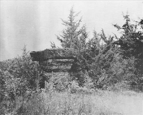
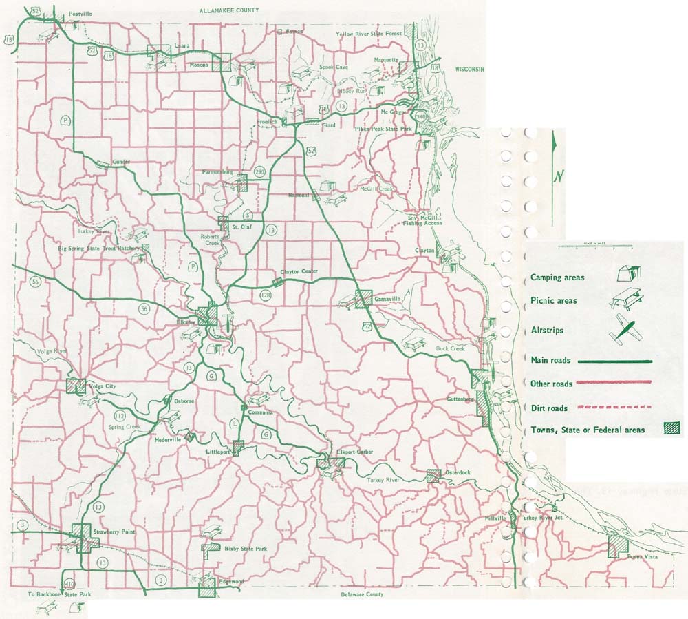 Above: Clayton county map - click to enlarge (opens in a new window) Right: Table Rock, located about 3 miles north of Elkader along State Highway 13. The Declaration of Independence was read here to a group of early settlers. |
 |
~*~*~ ~*~*~
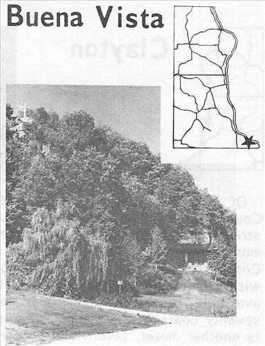
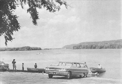
Buena Vista is located on the Mississippi in the Southern-most part of the area. In the town itself there is a general store, two taverns, gasoline available and a Catholic Church. Down on the river there is a public boat launching ramp, cottages for rent and trailer space. The operator here has room for about 44 boats in sheltered slips and pull ins. There is room for boats and trailers in shelters. Fishing boats are for rent, bait, block and cube ice, white gas, ice cream and soft drinks are available. The road to Buena Vista is worth taking just for the beautiful views and the town is uniquely charming. The photo on the left shows the lovely grotto in town.
~*~*~ ~*~*~
 |
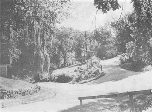
Of all the places in the area, Clayton to me presents a feeling of "old worldness" or "Old Country". Somehow I feel more relaxed there with the old buildings, the river and the sun drenched streets in the summer. It just seems to slow you down—which l think, is—wonderful. Still there must be progress and here we find a public boat ramp built by the Clayton County Conservation Commission and the town of Clayton in Co-operation. There is a picnic shelter on the waterfront with a beautiful view up the Mississippi. The resort in Clayton has boat rental and fuel, guides available, restaurant-tavern and motel. Another facility has fishing boats and bait with room for seventy boats in the dock. There is a park with facilities for camping and trailer parking. There is another motel, tavern and grocery store and gasoline is available. An old landmark is the old rock school house with its annual reunion. Clayton is also the home of E. Stanley Jones, generally considered to be one of the foremost Christian Missionaries of our time. |
~*~*~ ~*~*~
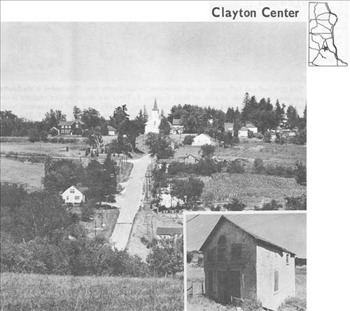
Clayton Center is a small community between Elkader and Garnavillo on highway 128. There is Clayton Center a service station-store. An article written in 1856 by two news editors from Dubuque said, "five miles East of Elkader is a new town just out of the woods and yet in its first days of infancy, which may make something yet. It is settled by a German colony, the most of whom have already built for themselves small stone houses." Now, well over a hundred years later, as a town, it is still in its infancy; the main difference being that the homes are a hundred years older. The possibility of its being the county seat never materialized. Be sure to see the old odd shaped house along the highway down near the creek. Zion Lutheran church is here.
~*~*~ ~*~*~
 |
 |
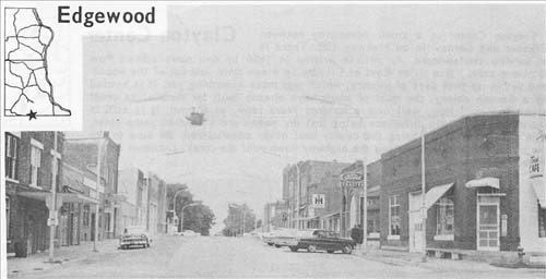
Edgewood is a half and half town, on the Delaware-Clayton county line. This makes it the Southern-most town in the guide located on State highway 3. There are seven service stations in town (2 with major repairs), a Ford dealer, two grocery stores, a sundry store, and coin operated laundry, barber and beauty shops, 2 cafes, 2 taverns, 2 hardware stores and a lumber yard. The town has three churches, Catholic, Congregational, and Methodist. There is a doctor in town. The city park is located right on Highway 3, on the North side in the center of town. There are fifteen picnic tables, a shelter, water and a fireplace. Lots of swings for the kids too. No camping here, as far as l can tell. Population in 1960—767.
~*~*~ ~*~*~
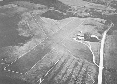
Elkader airstrip, N-S strip, 1980 ft., 1900 ft. useable, lighted, very clear approaches so length not such a factor. Altitude 915 ft. Moderate valley fog. |
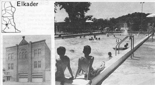
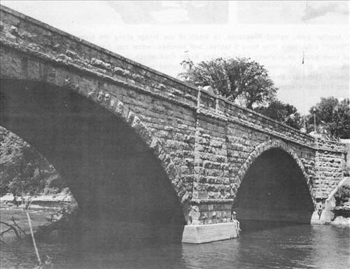
Elkader, on the Turkey River, the county seat of
Clayton County, has good facilities for campers and
picnickers. The recreation park, formerly the
fairgrounds, is on the "East" side of the river
over the beautiful twin arch keystone rock bridge. There
are 40 picnic tables there, some under shelter. Water and
toilets nearby. Elkader has a good swimming pool and many
swings, slides, and rides in the park area around the
pool. Camping is free in this area. |
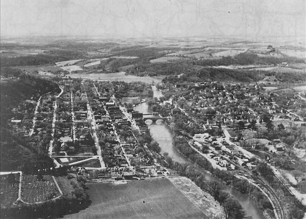
With the Turkey River flowing down the center and the hills
surrounding it, Elkader is one of the prettiest towns around.
~*~*~ ~*~*~
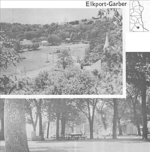
The twin towns of Elkport and Garber are typical of the small towns that grew up along the Turkey River when the area was first settled. Here the Volga and Turkey Rivers merge on their way to the Mississippi. The paved county road South of Elkader off Highway 13 takes you to these two towns. Garber has a little park with three picnic tables and a fireplace. Population 1960— Elkport 100. Garber 148.
~*~*~ ~*~*~
 |
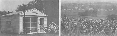
South of
Monona and just north of St. Olaf, Farmersburg lies
pretty well off the beaten track. It’s a town of
well tended gardens and homes that slope gently down to
the West. The antique shop pictured below could be of
interest to some. There are 2 service stations, a
hardware store, grocery, grocery-locker plant, tavern,
and lumber yard in town. The central little park has
swings and picnic tables, water and fireplace next to the
town hall. Population in 1960—250.
|
~*~*~ ~*~*~
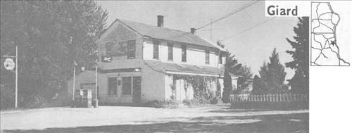 |
Giard. In November of the year 1800 Don Carlos Delassus, the Lt. Governor of Louisiana granted to Basil Giard, a strip of land roughly six miles long and a mile and a half wide running West from the Mississippi just South of McGregor. The town is located in this claim on U.S. 18 and consists of a general store, a Methodist church, and several homes. Gasoline and groceries are available at the store but there are no formal camping or picnic facilities. |
~*~*~ ~*~*~
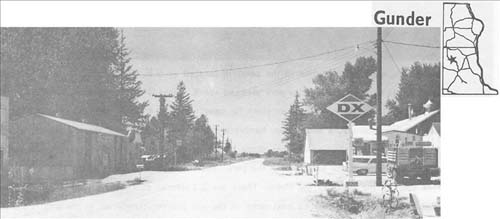
Gunder is a little Norwegian community located on the Postville-Elkader road. There is a general store, service station and Lutheran church. No picnic or camping facilities. The road was paved since this photo was taken.
~*~*~ ~*~*~
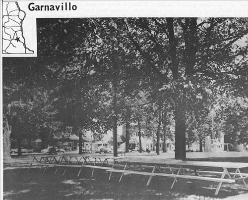 |
Garnavillo, once Jacksonville in the past, is located on U.S. Highway 52 North of Guttenburg. The town is built around the city park. There is water and about ten picnic tables. To my knowledge there are no provisions for camping in the town or surrounding area. There are five service stations, a body shop, hardware store, two taverns, two grocery stores, a cafe, a drug store, beauty shop and barber shops in the town. Swings and other playground equipment are located over at die school near the park. There is a public phone in the park too. just outside town to the North is the Motel. There are 2 Lutheran churches, a Catholic church, and a Gospel Hall. Someone may be interested in the two pioneer cemeteries in the area. Population in 1960—662. |
~*~*~ ~*~*~
~source: undated booklet, ca1960's, written by "Apple Jack"
~scanned & transcribed by Errin Wilker.
~*~*~
Northeast Iowa Hills - pg 2 * pg 3 * pg 4
Return to Clayton co. Directory & Gazetteer index
Return
to Clayton co. Photo index